Category Archives: S.E. Ward Local History
Update, Blackrock Harbour and Village Renewal Project, April 2016
In response to a recent question to the Chief Executive of Cork City Council by Cllr Kieran McCarthy for an update on the current work programme of the Blackrock Harbour and Village Renewal Project, a report was issued. The construction period for phase 1 has commenced, comprises 43 weeks and the project should be substantially completed in January 2017. This will consist of the realignment and widening of Convent Road, Blackrock Road and the Marina including boundaries, footpaths, surfaces, crossing and underground utility works common to phases 1 and 2. The scope of work will be limited to the current level of available funding. Further efforts will be made this year to secure the remaining funding so that work on phase 2 can commence at an early date. Funding applications have been made to a number of agencies including the Department of Agriculture, Food and the Marine, the National Transport Authority and the South East Regional Authority. Unfortunately, however these applications have not been successful. In the absence of additional funding, the Council proposes to split the tendered works into phases and to proceed with that portion of the works that can be executed. Commenting, Cllr McCarthy noted: “this has been a long, difficult and frustrating process of planning work over two decades. It’s a testament to the tenacity, patience and good will of Blackrock residents who have pushed and pushed to make this current construction phase happen”.
Kieran’s Our City, Our Town, 14 April 2016
Kieran’s Our City, Our Town Article
Cork Independent, 14 April 2016
Talk on Daily Life in 1916
Next Saturday 16 April at 11am, as part of the Lifelong Learning Festival Week, I will give a talk on Cork and daily life in 1916 in the Cork City and County Archives in Blackpool (all free, all welcome). It will form part of the half day seminar entitled Cork and the Easter Rising. Speakers will also include Dr John Borgonovo (UCC), Cork and the 1916 Rising (12noon); at 1.30 pm Rosaleen Underwood (Prof. Genealogist) will speak on Roibárd Langford, His Family History and his role in 1916 in Cork (Lieutenant, Cork No. 1 Brigade). Mark Cronin will speak on Blackpool in 1916: A Cork Suburb at the Crossroads (2.30 pm). Come for one talk or all of them. Booking at 0214505887.
I am currently working on a project that takes the year 1916 from the point of view that there were multiple conversations to be heard during the year – a kaleidoscope of ideas which provided the context and framework for revolution – everyday life being one – some led Cork citizens to connect with the Republican mantra at the time and others to just maintain existence, survive and struggle with the bleakness of a national and local economy. Entering the Cork Examiner on 1 January and progressing page by page one discovers key nuggets about the nature of Cork society, the soul of Ireland’s southern capital, the ongoing conversations about maintaining a contemporary status of being one of Ireland‘s distinguished port cities, and all the advantages and problems that run with that.
January 1916 begins with the aftermath of a winter storm – buildings were windswept and damaged, transport networks such as the City’s tramways were indented – as such there was nothing the Corporation of Cork and the citizens could do but sit it out and wait; much was out of their hands; the storm was something bigger than themselves. Indeed, the thread ‘much was out of their hands’ permeated throughout Irish society at this time – pervaded Cork society at this time. Despite, the rationing of food and materials, the pulses of society in Cork retained it as an ambitious place. Unemployment, jobs, requests for wage increases, Union Interventions, the role of employers and the needs of rate-payers reverberate in the pages throughout the year. The debates of the Cork industrial Association pops up in discourse throughout the pages of the paper, their efforts culminating in the large scale announcement of Ford Tractor and Car manufacturing coming to Cork in 1917. The Cork Harbour Board revelled in this announcement as well as plans for the physical rejuvenation of its quays. Another artery of the city was its train network travelling into County Cork. One can read about the benefits of such lines as the Cork Bandon and South Coast Railway, the Cork Muskerry Tram, the Cork Blackrock and Passage Railway Line connecting people, animals, fisheries and place from the coast and hinterland to the city and vice-verse – igniting the region and city into one. The same direction was pushed by the Munster Agricultural Society – whose aims consistently led to discussions on the role of land, cattle, the prices of Ireland’s traditions and industries – exports destinations, and ultimately the intertwinement into the British Empire.
The city’s institutions such as its hospitals – Mercy Hospital, South and North Infirmary, and institutions such as the City and County gaols, the Magdalene Asylum, the Sailor’s Home as well the City’s workhouse or Cork Union record the need to address the needs of society and to provide more financial aid and food to citizens immersed in large scale poverty.
The other pillars of Cork Society were its educational ones – the core schools that appear are the North Monastery, the South Presentational Convent, Crawford Municipal Technical Institute and the Cork School of Commerce. All continue through the press to showcase the importance of education and life-long learning in escaping from poverty and to help the overall societal pull to a better life.
The role of the Catholic church in society is ever felt – the refusals to leave cinemas open on a Sunday, the role of public professions of faith in galvanising public expressions of religion through events such as the confraternities and Corpus Christi, are written about in depth. The death of Bishop O’Callaghan ended another chapter in the city’s religious life and opened a new one on the rise of Bishop Cohalan and his take on non-violence and faith-based community approaches.
The public representation by City Councillors and Lord Mayor Butterfield on municipal issues from the provision of social housing to park provision is enormous– there is the role of escapism in the programmes of Cork Opera House, the Palace Theatre – and even in Cork Park Racecourse – as horses galloped across its mud-soaked landscape. GAA matches, athletics, handball, cricket are all recorded in depth on the Monday edition.
There is much to learn from this time – not just on the political side but that life itself in any city keeps moving and that society needs to grow and evolve with it – and that even from a dark time in Ireland’s past, there is much to learn about the diverse framework of historical events and how they shape our lives and our future.
Captions:
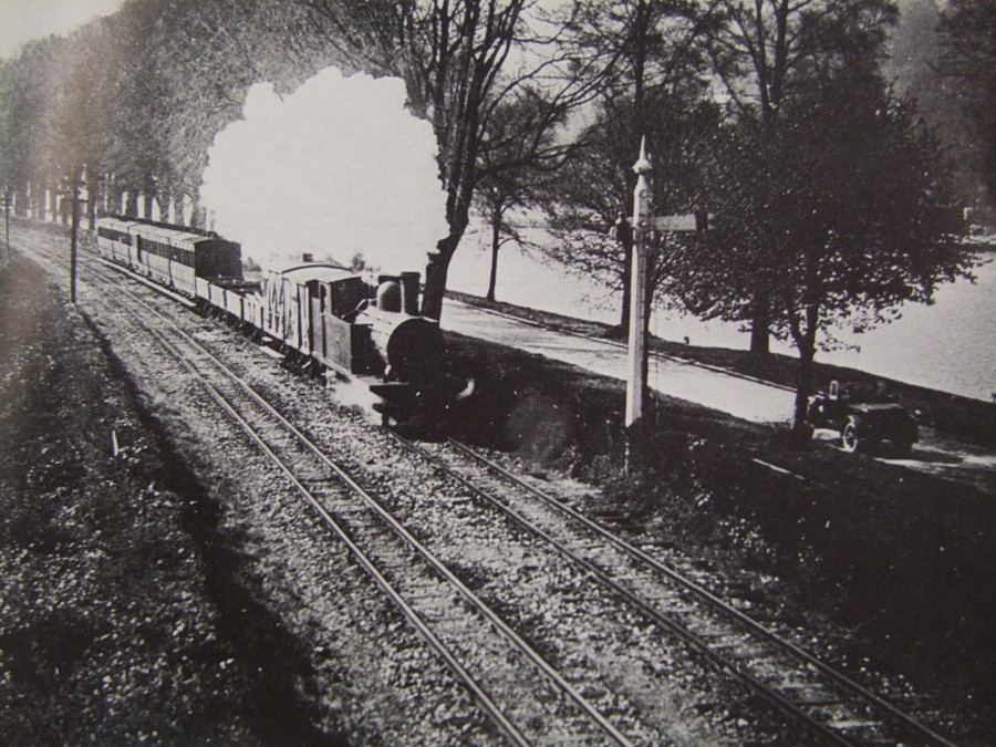
839a. Cork Blackrock & Passage train, The Marina, c.1920 (Source: Cork City Library)
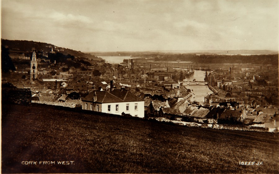
839b. View of Cork c.1910 (source: Cork City Museum from the book, Cork City Through Time by Kieran McCarthy & Dan Breen)
Kieran’s Talks, Lifelong Learning Festival Week 2016
For the forthcoming Lifelong Learning Festival Week, Douglas Road Cllr Kieran McCarthy will give a talk on some of the histories of West Cork through old postcards at the meeting room of the Church of the Real Presence, Curaheen on Wednesday 13 April, 10.30am. Based on his book, West Cork Through Time, Cllr McCarthy noted: “The talk focuses on in selective detail postcards from Cork City museum of the region of West Cork from one hundred years ago. It takes the reader from Bandon to Castletownbere through the changing landscapes and seascapes. This region is a striking section of Ireland’s coastline, over 320 kilometres in length, encompassing a raw coastal wilderness with expansive inlets eroded away by the Atlantic Ocean. The old postcards represent many memories of the landscape, sold to visitors and locals a century ago. There are places that charm, catch and challenge the eye. West Cork in itself is a way of life where individuals and communities have etched out their lives. It is a place of discovery, of inspiration, a place of peace and contemplation, and a place to find oneself in the world”.
Cllr McCarthy will also give a talk on Cork and daily life in 1916 in the Cork City and County Archives in Blackpool at 11am on Saturday 16 April (all free, all welcome). It will form part of the half day seminar entitled Cork and the Easter Rising. Kieran is currently working on a book that takes the year 1916 from the point of view that there were multiple conversations to be heard during the year – a kaleidoscope of ideas which provided the context and framework for revolution – everyday life being one – some led Cork citizens to connect with the Republican mantra at the time and others to just maintain existence, survive and struggle with the bleakness of a national and local economy. Cllr McCarthy noted: “Entering the Cork Examiner on 1 January and progressing page by page one discovers key nuggets about the nature of Cork society, the soul of Ireland’s southern capital, the ongoing conversations about maintaining a contemporary status of being one of Ireland‘s distinguished port cities, and all the advantages and problems that run with that”.
Kieran’s Our City, Our Town, 10 March 2016
Kieran’s Our City, Our Town Article,
Cork Independent, 10 March 2016
Cork Harbour Memories (Part 52)
A Besieged Cork 1642
The defence of County Cork from the Confederate army rested with the Lord President of Munster, Sir William St Leger (1586 –1642). Very little is compiled in a general sense of what happened in the wars around the walled town of Cork. I came across an interesting and old article on the Siege of Cork in 1642 by James Buckley in the “Journal of the Cork Historical and Archaeological Society” from 1916. In an attempt to reconstruct a balanced point of view, he draws from seventeenth century manuscripts, letters and House of Commons speeches. He denotes that in the year leading up to Liscarroll and West Cork battles in 1642 (see previous articles), St Leger frequently requested for men of war and munitions from Dublin.
In February 1642 St Leger resolved on abandoning the open country of County Cork in an effort to keep a few ports open and to keep open his sea communication with Dublin. St Leger evacuated his home at Doneraile and withdrew to the walled town of Cork. The exact troop of force that retreated with him is not definitely known but there is an estimate of 2,000 foot soldiers and two complete troops of horse. A considerable number of English settlers in County Tipperary and other parts of Munster also withdrew to Cork and Youghal for protection. In addition to the retreating forces the walled town of Cork probably possessed a number of sympathisers capable of bearing arms. The batteries at Elizabeth Fort and Shandon Castle (now the site of Firkin Crane) were manned, and it is estimated that St Leger then had close on 3,000 effective foot soldiers at his command.
On St Leger securing himself within the gates of the walled town of Cork, the Irish Army approached the settlement and they blocaded the town preventing the landing of fresh troops. The army divided into two sections, one of which was under the command of Jeremy Long, the High Sheriff of the County, and Barry Óg. They were quartered at Belgooly, three miles to the north of Kinsale; the other commanded by General Barry, was encamped at Rochfordstown, three miles to the south of the town. These forces had participated in other battles as well in County Cork – comprising an estimate of some 3,000 foot soldiers. They were afterwards reinforced from West Cork and Kerry, but their combined number is quite uncertain, and probably fluctuated from 4,000 to 6,000 foot soldiers with perhaps a hundred horse.
One event that affected both sides was the landing of English commander Sir Charles Vavasour at Youghal on 20 February 1642, with 1,000 foot soldiers. He relieved the town that was then closely besieged by the Confederates. He then pushed his army into County Waterford. He provided hope of breaking Irish lines and kept the sea link open between Youghal and Cork. Meanwhile reinforcements still kept pouring into the walled town of Cork. On 18 March, Lord Inchiquin, a son-in-law of St Leger, landed at Youghal from Minehead, and on 20 March put to sea for Cork. Captain Pigott arrived from Dublin about the same time with fifty of St Leger’s old company. Captain William Jephson, with two troops of horse, 100 in each troop, one for himself and the other for Lord Inchiquin, landed at Youghal on the 19 March, and brought over a quantity of powder and ammunition, and reached Mallow with both troops about 25 March.
The walled town was besieged on the north side by Lord Muskerry, MacCarthy Reagh, and many of the chieftains of the western districts. St Leger heard that Lord Roche, Lord Ikerrin, Lord Dunboyne, the Baron of Loghmoe, Richard Butler, brother to the Earl of Ormond, and all the Tipperary forces were drawing together with the object of beleaguering him on the south side. In the first week of April 1642, he ordered the two troops of horse recently landed to create a diversion in north-east Cork under the command of Lord Inchiquin and Captain Jephson. This movement resulted in guerrilla warfare with some minor success. They relieved Rathgogan Castle (in present day Charleville), Ballyhay Castle and re-established a garrison at Doneraile. The two captains then withdrew to the city.
On 5 April 1642 the Irish forces at Belgooly struck camp and joined the main body near Cork. Owing to an absence of cannon, muskets and ammunition, the Irish confederates were unable to storm the walled town. This position continued till 13 April when an incident occurred. On the morning of that day a party from the Cork garrison was out on a scouting and foraging expedition. They encountered a detachment of the Irish a mile or so from the city, who drove them back to the suburbs. The English captains came forth with four troops of horse and 600 musketeers. They drove back the Irish and attacked a party then in ambush. Support from the Irish lines came forward, but all were pushed back in disorder. The English then rushed forward and took the main body by surprise. The cavalry broke in and disordered the lines and a general retreat was called. The Irish then scattered, many advancing into County Limerick to help with the Confederate war there.
To be continued…
Captions:
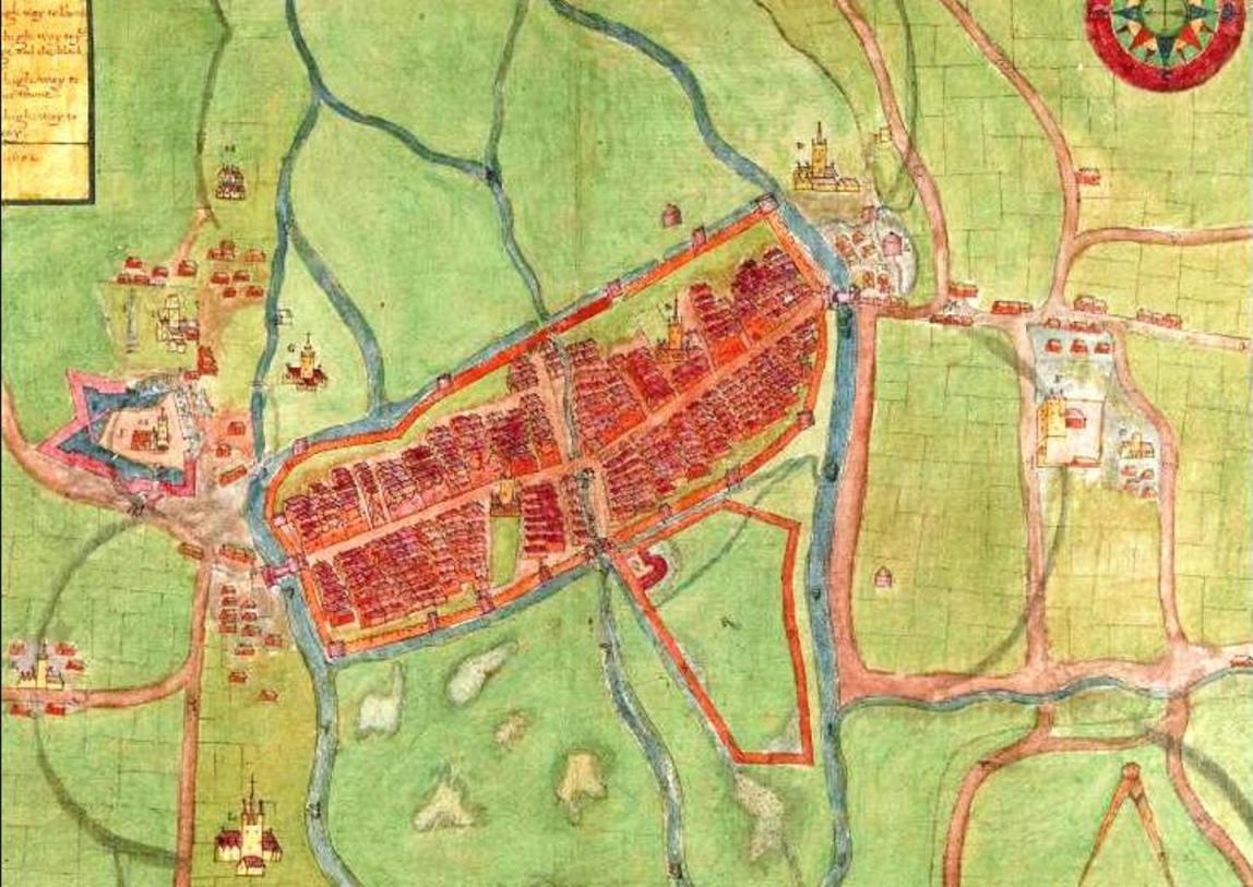
834a. A description of the Cittie of Cork/ Plan of Cork, circa 1602 by George Carew, showing Elizabeth Fort on the left and Shandon Castle on the right (source: Hardiman Atlas, Library of Trinity College Dublin)
834b. Section of Down survey map of Cork City, c.1655/56 (source: Cork City Library)
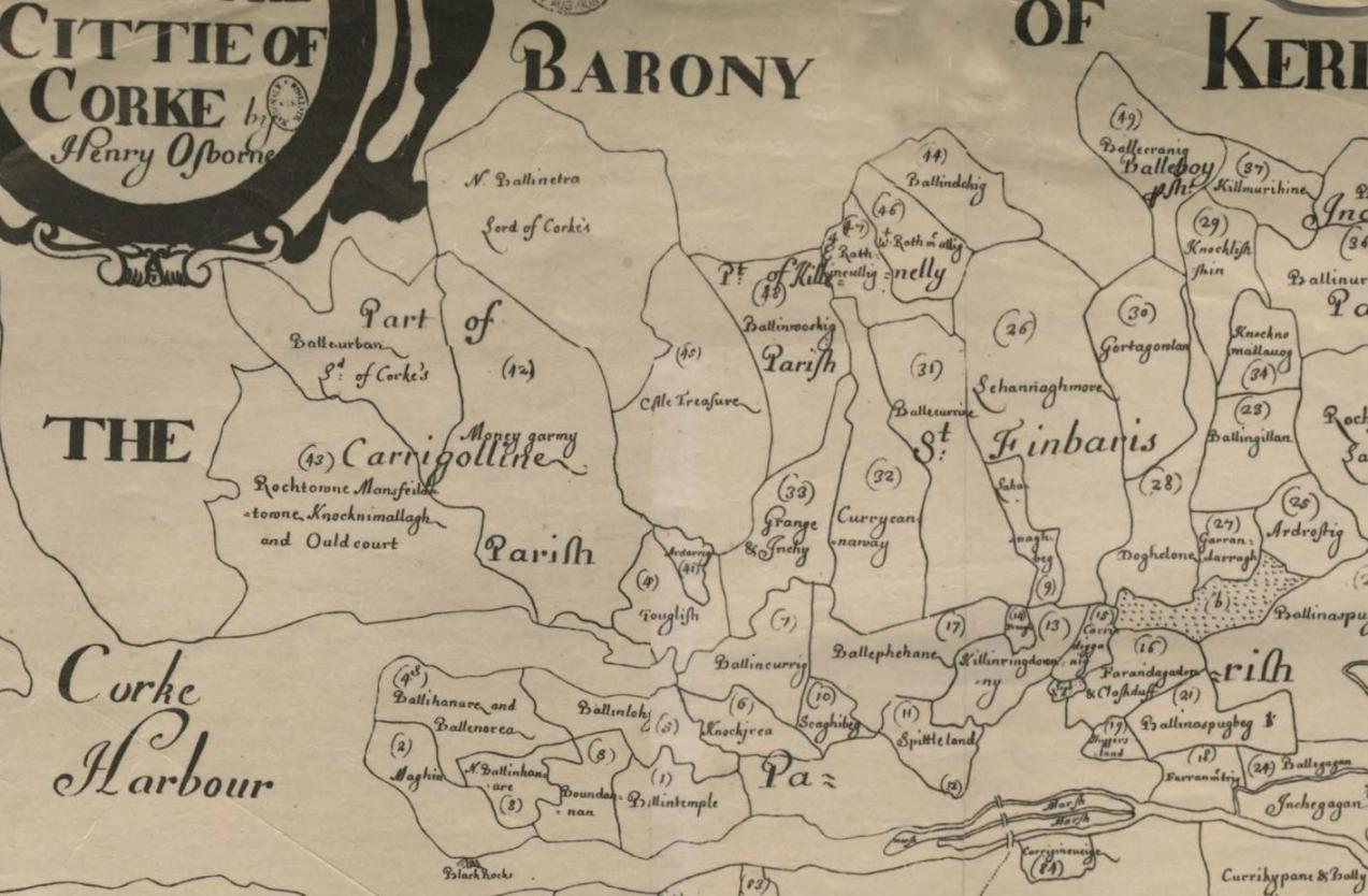
Update, Blackrock Harbour and Village Renewal Project, 11 January 2016
In response to a recent question to the Chief Executive of Cork City Council by Cllr Kieran McCarthy for an update on Blackrock Harbour and Village Renewal Project, the reply below was given. The construction tender phase for the renewal project was undertaken in 2015 and a preferred contractor selected. The value of winning tender exceeds the available budget assigned. Consequently additional funding is required to deliver the full scheme. Funding applications have been made to a number of agencies including the Department of Agriculture, Food and the Marine, the National Transport Authority and the South East Regional Authority. Unfortunately however these applications have not been successful.
In the absence of additional funding, the Council proposes to split the tendered works into phases and to proceed with that portion of the works that can be executed. It is intended that the first phase will be commenced in early 2016. This will consist of the realignment and widening of Convent Road, Blackrock Road and the Marina including boundaries, footpaths, surfaces, crossing and underground utility works common to phases 1 and 2. The scope of work will be limited to the current level of available funding. Further efforts will be made this year to secure the remaining funding so that work on phase 2 can commence at an early date.
Kieran’s talk, Cork Harbour Through Time
Public talk with Kieran, Cork Harbour Through Time – explore the old postcards of one hundred years ago, histories and memories of Cork Harbour, with Passage Historical Group, Wednesday 21 October 2015, 8pm; all welcome.
Kieran’s Our City, Our Town, 15 October 2015
Kieran’s Our City, Our Town Article,
Cork Independent, 15 October 2015
Cork Harbour Memories (Part 33)
A Busy Seventeenth Century Settlement
Cork in the first decades of the seventeenth century was valued as the third most important port after Dublin and Waterford. The growth in prosperity was mainly attributed to the increase in utilization of the surrounding pastoral hinterland surrounding the city. Large sections of woods were cleared in Munster to accommodate the large demand for pasturalism. However, in 1610, a report by the commission of the Munster Plantation noted that the woods were being depleted too fast in order to clear land so sheep could graze on it.
In the early 1600s, it is recorded that the main areas that Cork was importing from and exporting to included Seville in Spain, Lisbon in Portugal, St Malo and the Saintonge area in the south-west of France, cities in the north of Italy such as Pisa, western English port cities such as Bristol, Cologne and the Rhine area in Germany and towns such as Delft in northern Holland. New trading connections were also established with the Canary Islands and Jersey. The main imports from the first four countries in the above list mainly consisted of wine while from the others iron and salt were the principal imports. This is also reflected in the archaeological evidence from sites with preserved late medieval contexts. A large percentage of the pottery discovered dating to the seventeenth century was from the warm temperate countries where wine was grown.
Hides, tallow, pipestaves, rugs and friezes were the main exports along with cattle, wool and some butter. There was an increasing trade in beef, which led to the moving of slaughter houses or shambles outside the city walls. Indeed, such was the extent of active trade in Cork whether it be exporting or importing, that there was increased activity in the pirate activities. It eventually reached the stage where special convoys were introduced to protect merchant ships especially around the south coast.
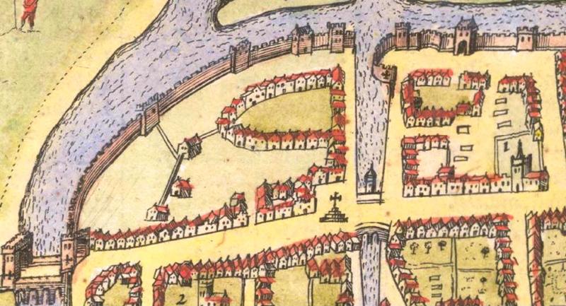
The physical nature of the walled city appears constantly in Cork Corporation priority list regarding revamps. The old Corporation records detail the worsening condition of the town walls. In January 1609, a plan to build a new court house on the site of King’s Castle, which was the northern control tower of the central Watergate into the town, was delayed. The walls onto which the courthouse were be attached were crumbling and in danger of collapsing. New walls would have to be built, so the new courthouse could be built.
The poor condition of the town walls continued to be a major issue for the Corporation into the decades of the 1610s and 1620s and even the bridges leading into the town were described as ruinous and calls were made for them to be mended. From 1614 on, all monies earned by the Corporation from taxing imports such as wine were to be spent the repairing of the walls. However, by 1620, it was agreed that the incoming revenue into the settlement’s coffers was not enough and a bye-law was passed where several municipal rates were to be brought in as well as increasing of existing rates. Taxes were raised on several regularly exported commodities such as animal feed such as oats, animal skins such as horse, deer, fox and on drinks such as beer and wine. However, the taxes regarding docking your boat, passage through the city, tax on the land you owned were abolished.
In 1620, an English traveller described Cork as “ a populous town and well compact, nothing to commend it…the town stands in a very bog and is unhealthy”. The physical state of the town also became an issue in May 1622 when lightning struck one of the thatched roofs in the eastern part of the city which caused a large scale fire to rapidly spread from one thatched roof to the next. According to the historical records, the fire began between eleven and twelve o’ clock in the morning. Indeed, apart from one clap of lightning there was also a second clap of lightning which lit the houses in the western part of the city. It is detailed that the since the houses overlooking the main street were in flames, the people trapped between the two fires were forced to flee into the city’s main churches, Christ church on South Main Street and St. Peter’s on North Main Street. Both of these churches are recorded as being constructed of stone and having a slated roof which saved the lives of numerous townspeople. The people who did not make into the churches were unfortunately consumed by the fire itself. In September 1622, an order was passed that the stone walls be built and the roofs be replaced by slate or timber boards.
The early seventeenth century was an era of unprecedented social upheaval whereby a large part of society consisted of a Catholic majority ruled by a Protestant sovereign. As the seventeenth century progressed, Catholicism became more a political movement than a religious one which aligned itself and made full use the church in Rome as a reason for rebellion.
To be continued…..
Captions:
814a. Depiction of Cork’s interior dock, the Watergate complex, from John Speed’s ‘Corke’ from his Province of Munster c.1610-11 (source: Cork City Library)
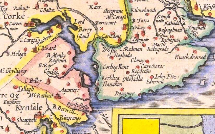
814b. Depiction of Cork Harbour and East Cork from section of John Speed’s Province of Munster, c.1610-11 (source: Cork City Library)
Kieran’s Our City, Our Town, 8 October 2015
Kieran’s Our City, Our Town Article,
Cork Independent, 8 October 2015
Cork Harbour Memories (Part 32)
The Theatre of Empire
The online map archive of the city through the ages makes for great viewing at www.corkpastandpresent.ie. The early seventeenth century is well represented. One beautifully engraved and hand-coloured map is by John Speed (1552-1629) of the province of Munster taken from The Theatre of the Empire of Great Britaine (1611-12). In the corner of the map is a representation of the walled town of Cork. Though dated 1610 and mentioning London based publishers John Sudbury and George Humble. It was 1616 before it was actually published in Amsterdam by globe maker and map engraver Jodocus II Hondius with the assistance of George Humble, who also acted as Speed’s editor. Sudbury and Humble were the largest and most successful publishers and print-sellers in London.
The Munster map is embellished with an engraving of a man (a cartographer?) wielding a large pair of dividers, while he stands on top of the scale of Irish miles; in Youghal harbour is a galleon ship and in the Atlantic is a boy playing the harp whilst sitting astride a remarkable winged sea creature. Present day Munster comprises six Irish counties but the province has to this day many churches and ancient castles that are depicted on this map. The map abounds with the names of local clans and families – it is inscribed in a very personal way – but its use was also political showing the controlled hidden corners of the British empire.
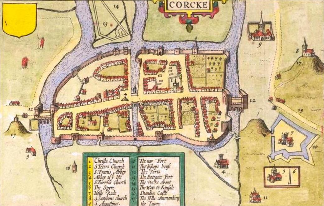
There are two inset town plans on the map of the most prominent towns in the province at the time – Cork and Limerick, both of which were fortified with large town walls and built on rivers. In the Cork map, the northern suburbs, present day Shandon Street is shown along with Shandon Castle and the remains of the Franciscan Abbey on the present day site of the North Mall. In the southern suburbs, structures such as the Augustinian Abbey, the earthen ramparts of Elizabeth Fort, while further west an old medieval church associated with the remains of a round tower encompassed by a wall are depicted.
The Oxford Dictionary of National Biography records that John Speed as beginning his working life as a tailor in the northern English county of Cheshire. He pursued his apprenticeship under his father, a local tailor, and carried on the family business for a number of years. His attention to detail and a keen interest in cartography, led him to try his hand at map making. He began to display a uncharacteristic talent for this and, despite still working as a tailor, Speed created and published his first known map in 1595 – a map of Canaan.
Soon afterwards, Speed was patronised by Sir Fulk Revil, It was this generosity that allowed Speed to depart for London, still as a teenager, and focus on his education at the College of Antiquaries. He became absorbed in his studies, developing his keen interest in history, and soon a specialist interest in the history of cartography. With the help and advice of various associates of Sir Fulk Revil, he pursued the notion of creating a complete and precise atlas of the British Isles.
Speed took the first step with his home county of Cheshire, completing the map with one of the earliest town plans of Chester with arms and vignettes which were to become his signature style. Engraved by William Rogers, this map was published individually in 1604. He continued to cover all the counties of England and Wales. The resulting atlas, finally published in 1612, was titled The Theatre of the Empire of Great Britaine. This remarkable work was published in partnership with the already established house of John Sudbury and George Humble. The atlas, bought by the University Library in 1968, is now considered priceless. It contains a single sheet for each county of England and Wales, plus a map of Scotland and each of the four Irish provinces, and paints a rich picture of the countryside at the turn of the seventeenth century. Cambridge University Library is home to one of only five surviving proof sets. Their map department elegantly describes Speed’s maps: “Rivers wriggle through the landscape, towns are shown as huddles of miniature buildings, woods and parks marked by tiny trees and – with contour lines yet to be invented – small scatterings of molehills denote higher ground”.
The ‘Theatre’ was a great success and was published again many times and by a number of publishers: Sudbury and Humble notably published their second edition of The Theatre in 1627, the last edition to be published before Speed died. In 1627, Speed released his other major work: A Prospect of the Most Famous Parts of the World. This finely detailed and embellished world atlas, the result of many years development alongside The Theatre, includes the notable accolade of being the first world atlas to be published by an Englishman. The Prospect was to be his last major work. John Speed died on 28 July 1629 having created some of the most remarkable cartography.
To be continued…
Captions:
813a. Section of John Speed’s Province of Munster, from Speed’s The Theatre of the Empire of Great Britaine, c.1610-11 (source: Cork City Library)
813b. John Speed’s ‘Corke’ from his Province of Munster (source: Cork City Library)
Kieran’s Our City, Our Town, 12 September 2015
Kieran’s Our City, Our Town Article,
Cork Independent,
Discover Cork: Schools’ Heritage Project 2015-16
10 September 2015
This year coincides with the thirteenth year of the Discover Cork: Schools’ Heritage Project. Again launched for the new school term, the Project is open to schools in Cork; at primary level to the pupils of fourth, fifth and sixth class and at post-primary from first to sixth years. There are two sub categories within the post primary section, Junior Certificate and Leaving Certificate. A student may enter as an individual or as part of a group or a part of a class entry.
Co-ordinated by myself, one of the key aims of the project is to encourage students to explore, investigate and debate their local heritage (built, archaeological, cultural and natural) in a constructive, active and fun way. Projects on any aspect of Cork’s rich heritage can be submitted to an adjudication panel. Prizes are awarded for best projects and certificates are given to each participant. A cross-section of projects submitted from the last school season can be gleamed from this link on my website, www.corkheritage.ie where there are other resources, former titles and winners and entry information as well.
Students produce a project on their local area using primary and secondary sources. Each participating student within their class receives a visit and workshop in October 2015. The workshop comprises a guide to how to put a project together. Project material must be gathered in an A4/ A3 size Project book. The project may be as large as the student wishes but minimum 20 pages (text + pictures + sketches). Projects must also meet five elements. Projects must be colourful, creative, have personal opinion, imagination and gain publicity before submission. These elements form the basis of a student friendly narrative analysis approach where the student explores their project topic in an interactive and task oriented way. In particular students are encouraged to attain material through visiting local libraries, engaging with fieldwork, interviews with local people, making models, photographing, cartoon creating, making DVDs of their area. Re-enacting can also be a feature of several projects.
For over thirteen years, the project has evolved in how students actually pursue local history. The project attempts to provide the student with a hands-on and interactive activity that is all about learning not only about heritage in your local area (in all its forms) but also about the process of learning by participating students. The project is about thinking about, understanding, appreciating and making relevant in today’s society the role of our heritage- our landmarks, our oral histories, our scenery in our modern world for upcoming citizens. So the project is about splicing together activity on issues of local history and heritage such as thinking, exploring, observing, discovering, researching, uncovering, revealing, interpreting and resolving. This year as well there is a focus on the 1916 commemoration side with projects on the centenary being encouraged.
The importance of doing a project in local history is reflected in the educational aims of the history curricula of primary and post-primary schools. Local heritage is a mould, which helps the student to become familiar with their local environment and to learn the value of it in their lives. Learning to appreciate the elements of a locality, can also give students a sense of place in their locality or a sense of identity. Hence the Project can also become a youth forum for students to do research and offer their opinions on important decisions being made on their heritage in their locality and how they affect the lives of people locally. Over the years, I know a number of students that have been involved in the project in schools over the years who have took their interest further and have gone on to become professional tour guides, and into other related college work.
The project is open to many directions of delivery. Students are encouraged to engage with their topic -in order to make sense of it, understand and work with it. Students continue to experiment with the overall design and plan of their work. For example in general, students who have entered before might engage with the attaining of primary information through oral histories. The methodologies that the students create provide interesting ways to approach the study of local heritage. Students are asked to choose one of two extra methods (apart from a booklet) to represent their work. The first option is making a model whilst the second option is making a DVD. It is great to see students using modern up todate technology to present their findings. This works in broadening their view of approaching their project.
This project in the City is kindly funded by Cork City Council (viz the help of Niamh Twomey), the Heritage Council and Cork Civic Trust (viz the help of John X. Miller). Prizes are also provided by the Lifetime Lab, Lee Road and Sean Kelly of Lucky Meadows Equestrian Centre, Watergrasshill (www.seankellyhorse.com). There is also a County Cork edition. Overall, the Schools’ Heritage Project for the last thirteen years has attempted to build a new concerned generation of Cork people, pushing them forward, growing their self-development empowering them to connect to their world and their local heritage. Spread the word please.
Captions:
809a. Deirdre Moriarty getting ready to prepare the Rokk Choir at the recent Coal Quay Festival (picture: Kieran McCarthy).
809b. A walking tour getting underway at Elizabeth Fort during the recent Cork Heritage Open Day (picture: Kieran McCarthy)