Category Archives: Landscapes

Kieran’s Our City, Our Town, 11 February 2016

830a. St Mary’s Roman Catholic Church Mallow, c.1900

Kieran’s Our City, Our Town Article, 

Cork Independent, 11 February 2016 

Cork Harbour Memories (Part 48)

Jephson Legacies at Mallow


   Mallow town developed rapidly in the late sixteenth century and seventeenth century as an English plantation town. Mallow castle was burned down by supporters of James II in 1689, marking the end of its use. Instead of restoring the house, the Jephsons converted other buildings into a new residence. Shortly afterwards a new bridge nearby was built over the River Blackwater. The section of four small arches on the town side of Mallow Bridge is all what remains of the first stone bridge over the river. Built in 1712, it had a total of fifteen arches. During the severe flood of 1853 several of the arches were swept away and others were severely damaged. This section was replaced by a new bridge of four arches in 1856. On the bridge stands a monument to the volunteers of the old Irish Republican Army of the Mallow area who gave their lives in the War of Independence.

   Throughout the centuries the town has prospered as a market town, helped by the River Blackwater, its rich agricultural hinterland, its central location and its importance on the railway network. In the eighteenth and nineteenth centuries, through the Jephsons, Mallow became famous as a spa resort and became known as ‘The Irish Bath’. Pigot’s Directory of 1824 describes Mallow as follows: “The modern structures consist of a handsome church, and a new market house, with convenient buildings adjoining, erected by the present proprietor; here also are chapels for Roman Catholics, Wesleyans, Calvinists and Independents. Contiguous to the town is a spring of moderately tepid water, bursting from a limestone rock; its medicinal qualities attract a numerous assemblage of fashionable society, for whose convenience commodious baths are about to be erected; it was discovered in the year 1724, and in quality assimilates to the hot water of Bristol – its temperature is 68 ½ . Mallow since the year 1803 has returned one member to the Imperial parliament, elected by a seneschal and freeholders”.

  The Jephson legacy permeated into the nineteenth century. This is evident in the history of the some of the key historic buildings in the town. A descendant of Sir John Jephson, husband of Elizabeth Norrey was Charles Denham Jephson-Norreys who donated a site south of Main Street, Mallow for the construction of St Mary’s Roman Catholic Church. There in 1818 the Church of St Mary was built. This was a triumph in an intolerant time when the struggle for emancipation was still eleven years from victory. The new church was originally built behind a row of houses that stood along Main St. Access was by a narrow lane to the west and south of the present Credit Union building, formerly the National Bank. It was unacceptable in the days before Catholic Emancipation in 1829 to have a Catholic Chapel in a prominent position. These houses were gradually removed, thus providing a piazza fronting on to Bank Place.

   The new St Mary’s Church was cruciform in plan including a basic nave with side aisles and shallow transepts with galleries. Initially it had an earthen floor and no seats. During the first two decades of the twentieth century Canon Wigmore (P.P. 1881-1917) had the church enlarged and some of it rebuilt. He employed the services of Messrs Ashlin and Coleman architects to carry out this work. The interior was also embellished with a beautiful rib vaulted plaster ceiling and fluted columns this was the work of the Orangie family from Italy. In the 1990s the roof was found to be unsafe and it was completely re-roofed. Unfortunately, the ceiling executed by the Orangie family earlier in the century was unable to be saved. The ribbed vaulted portion over the nave was replaced by a plain tunnel vault.

   The spa house was built in 1828, by Charles Denham Orlando Jephson (1799-1888), MP. It is in the old English style of rural architecture, and in its day contained a small pump-room, an apartment for medical consultation, a reading-room, and baths. The building was fitted up for supplying at short notice, hot and cold salt-water, vapour, and medicated baths. The approach to the spa from the town was and still is partly through an avenue of lofty trees along the bank of an artificial canal, affording great scenery.

   Situated in the heart of Mallow town centre and overlooking Main Street to the north, is one of the town’s most recognisable landmarks – the clock tower. The half timbered Tudor style facade fills the building with character. It was built around 1855 using the designs of Charles D O Jephson who also dabbled as a local amateur architect. The building was once a licensed premises. The bell tower became structurally unsound and was removed around 1970 for safety reasons. The building has been used as offices for many years and the owners have recently invested a considerable sum in works to bring the internal of the building to a high standard. Adjacent today stands the Thomas Davis Statue in remembrance of an eminent Irish statesman, writer, and one of the instigators of the Young Ireland Nationalist movement.

To be continued…

For more on North Cork history, check out Kieran’s and Dan Breen’s new book, North Cork Through Time (2015).


Captions:

830a. St Mary’s Roman Catholic Church Mallow, c.1900 (source: Cork City Museum)

830b. Spa House, Mallow, c.1900 (source: Cork City Museum)

830c. Clock House, Mallow, c.1900 (source: Cork City Museum)


830b. Spa House, Mallow, c.1900

830c. Clock House, Mallow, c.1900

Update, Tramore Valley Park, February 2016

    Tramore Valley Park is unlikely to open before this summer. The director of Services in Cork City Council’s Environment and Recreation Department said substantial work is needed to be done, before the park could open beyond its current, limited hours. It was also revealed that a shortfall of e.100,000 is needed to finance the park opening in the short term. The director said: “specific provision for the operation of the Tramore Valley Park was not made in the 2016 budget. There are also essential engineering works required. It is expected that these will be completed by mid-summer. It is hoped that, at that time, a sustainable funding model will also be in place to facilitate a full opening”. At present, Tramore Valley Park opens on Saturday mornings to accommodate a BMX track and rugby pitch.

   In a press release from the City Council, in recent weeks, numbers participating in the Cork parkrun have increased considerable, nearly trebling to 520 runners. The site can accommodate 240 cars, but reached capacity recently. The City Council has serious health and safety concerns regarding capacity to cater for such numbers of vehicles, given the proximity of the site to the South Link Road and the park run model not allowing for control of numbers by pre registration. In the event of not being able to cap participants and numbers of vehicles arriving at the site, and attendances increasing each week, the City Council reluctantly has no option but to withdraw permission for the event. The City Council will work with parkrun Ireland, to review the Tramore Valley parkrun to see if it can be tailored to meet necessary health and safety requirements on a more modest scale going forward.

    Raising the issue in the City Council chamber, Cllr Kieran McCarthy noted; “it’s all coming down to funding, small amounts of funding to finish and open the park; we have the Council’s park and ride facility nearby, it can accommodate a large number of cars and a shuttle buses; the question of finding funding to open the park long term needs to be a priority for the City Council; this park will provide a recreational facility for all of Cork citizens. Millions and millions of tax payer’s money has been invested in its development and it has come a very long way from being a landfill; keeping the park closed is in no one’s interest”.

Kieran’s Our City, Our Town, 4 February 2016

829a. Main Street, Mallow, c.1900

Kieran’s Our City, Our Town Article,

Cork Independent, 4 February 2016

Cork Harbour Memories (Part 47)

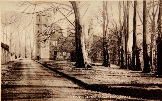
Inquisition at Mallow


   Continuing on from last week, an inquisition taken in the year 1611 reveals more information about the nature of early seventeenth century Mallow and the principal landowners. There were several who leased lands within the Jephson manor including the Hydes, Spensers (see last week), Cuffes, and Audleys. To fulfil the plantation of this area of North Cork, they all would have built their own fortified house as such on these lands.

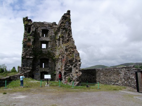
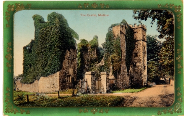
   Apart from Mallow Castle, another structure called Castle Garr or Short Castle was located on the northern side of the Mallow hamlet. It was the residence of Richard Aldworth with 300 acres in fee farm from the Jephsons. The Aldworth family originated in Berkshire, England, from whence Richard Alworth moved to Ireland at the time of Queen Elizabeth’s Irish wars. An Aldworth photograph album is kept in Cork City and County Archives. The legal document with the reference U2/2 includes a Pedigree of the Aldworths since their coming into Ireland. The first Richard got the estate of Short Castle, near Mallow, forfeited by the Earl of Desmond. His grandson, Sir Richard (d.1629), was appointed Provost Marshall of Munster, and married a daughter of Richard Boyle, Earl of Cork. The family was granted lands formerly owned by the MacAuliffe clan, including the Manor of Newmarket. There are letters patent from Charles I in 1639 renewing the grant. Newmarket House became the family seat, and many family members are buried in Trinity Church, Newmarket. Colonel Richard Aldworth married Elizabeth St Leger, daughter of Lord Doneraile by whom the Doneraile Estate and Title came into the family in the person of St Leger Aldworth his second son. Elizabeth (d.1775) is thought to have been the only woman ever admitted to the Masonic order.

   Historian Dr John F Berry wrote an extensive article, published way back in 1906, on the history of Mallow Castle estate in the Journal of the Cork Historical and Archaeological Society. In this article, he draws on and attempts to translate calendar state and other parliamentary papers to recreate the importance of the Mallow plantation. He records how small and large English communities worked together to made the Munster plantation project work. Some of his place names may not be the exact spelling of present day townlands and some places may have been subsumed by modern day place-names. However, he lists the fee farm holders of Robert Williamson (Starch House, 315 acres) and Roger Wallen (300 acres, Ballyfintery). Next are listed the lessees who had agreed terms for 21 years – Robert Hoames (300 acres, Cloghlucas), Gregory Newman (300 acres, Dromsligagh) William Smith (400 acres, Churbeston and Gortaghmore), Thomas Bettesworth (300 acres, Ballylogh), Thomas Bellamy (300 acres, Lower Quarter), John Gibbes (200 acres Corraghen Early), Thomas Langly and Walter Jenkins (360 acres, Upper Quarter), Philip Waghen (100 acres, Lackenyloagh), William Hollydaie (4 acres), Walter Harris (60 acres), Thomas Edwardes and William Newman and Donston Heard (120 acres), and Thomas Mylier (5 acres).

   The 1611 inquisition provides insight into the small hamlet of Mallow with a population of possibly 100 people (compared to over 10,000 people today). Recognition is given in the inquisition to the names of 25 copyholders, who held houses and gardens within the town of Mallow – John Wreg, John Joanes, George Harbert, Thomas Basnet, Cuthbert Eliott, Christopher Grigg, Thomas Dowdall, Francis Robinson, David Dawkins, William Peiton, Robert [ ], William Sloane, Hugh Laughan, Timothy Lee, Reynarde [ ], William Gilbert, John Uppcott, Mathew Harris, Nicholas Dodington, John Foster, Walter Harris, Christopher Gifford, Robert Hoames, Michae [ ], and Philip Vaghan.

    The inquisition fulfilled the terms of the plantation and the town was incorporated on 27 February 1613 to James I. Under the charter, the town was to be a free borough, and to be known as the borough of Mallow. Under it a corporation, consisting of a provost, twelve free burgesses and a commonalty was created, and Robert Holmes was named first provost. The provost and free burgesses were to have power to send two fit men to parliament.

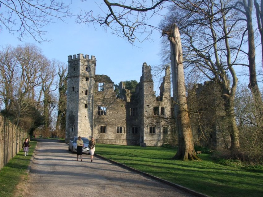
   Nineteenth-century antiquarian accounts record that on the breaking out of the Confederate wars in 1641, Mallow town comprised 200 houses occupied by English settlers, of which 30 were described as strongly built and roofed with slate. On 11 February, 1642, Confederate forces under Lord Mountgarret entered the town. On that occasion Captain Jephson entrusted the castle of Mallow to the custody of Arthur Bettesworth, with a garrison of 200 men, an abundant supply of arms and ammunition, and three pieces of ordnance. It held fast. Later in time, the castle of Mallow was assaulted and taken by the Earl of Castlehaven, in 1645, and was nearly reduced to ruins.

   In 1642 Castle Garr was to be defended by Lieutenant Richard Williamson, who, after sustaining repeated assaults, in which he lost most of his men, and several breaches had been made, agreed to surrender upon terms. After he had left the fortress, finding that the insurgents did not keep the terms of capitulation, Lieutenant Williamson and a party of men fought their way back through their ranks and retired into Mallow Castle, which had been maintained with better success by Bettesworth.

To be continued…

For more on North Cork history, check out Kieran’s and Dan Breen’s new book, North Cork Through Time (2015).


Captions:

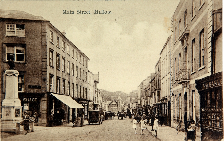
829a. Main Street, Mallow, c.1900 (source: Cork City Museum)

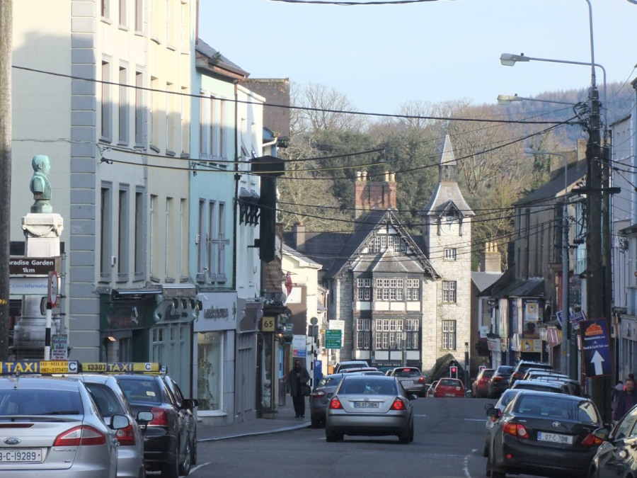
829b. Main Street, present day (picture: Kieran McCarthy)

829b. Main Street, present day

Kieran’s Our City, Our Town Article, 21 January 2016

827a. Postcard of Mallow Castle, c.1900

Kieran’s Our City, Our Town Article,

Cork Independent, 21 January 2016

Cork Harbour Memories (Part 45)

Stories at the Plain of the Rock


     Upstream on the Blackwater from Fermoy and shown on John Speed’s Map of Munster c.1610 (from The Theatre of the Empire of Great Britaine, 1611-12) is the historic town of Mallow. The name is derived from the Irish Magh Ealla (The Plain of the Rock). The original Mallow castle was built by the Anglo-Normans in 1185 AD, after the native O’Keeffe’s had been dispossessed. In 1282, the Desmond Fitzgerald’s built a new castle. Soon afterwards, a Baron of the Geraldines, Thomas Fitzmaurice, traded his land in Kerrylocknaun, Connaught, with the Desmond Fitzgeralds.

   After Thomas Fitzmaurice died in 1298, the land stayed in Geraldine hands until their rebellion in the closing stages of the sixteenth century, when the Earl of Desmond’s brother, Sir John of Desmond took possession of it. However, he and his wife, Ellen, had no children, so the castle was not inherited and left to decay. It then passed through a stream of owners, including Sir William Pelham and Sir John Norreys of Rycote in Oxfordshire. His brother, Sir Thomas Norreys, inherited the 6,000 acre estate in the late sixteenth century.

   The nearby town for centuries also formed part of the territories of the great Fitzgerald family, the Earls of Desmond. This place was one of the centres of the operations of the English forces in North Cork. After the rebellion of the Desmonds in the reign of Elizabeth, the Queen fortified the castle for the defence of the ferry across the river. In 1584, the castle and the manor were granted by the Queen to Sir Thomas Norreys/ Norris, Lord-President of Munster. Today walking around the grounds of the ruinous but impressive structure, information panels by Dúchas, the Heritage Service, detail that the fortified house was built between 1584 and 1599 by the Norreys. The building stone was taken from an older castle on the same site, which had belonged to the Fitzgeralds. The castle is a long building with projecting bays in the centres of the two long walls, with octagonal turrets at the corners of the front of the house. There were four storeys in the main block, including an attic and cellar space. Floors and room partitions comprised of wood, except for one stone wall across the middle of the building. There are small holes below the windows through which the muskets could be fired.

   Thomas Norreys (1556–1599) appears on several occasions in the Annals of the Four Masters and described in the Dictionary of National Biography of Great Britain. He was the fifth son of Henry, baron Norreys of Rycote and Wytham Abbey in Oxfordshire (the latter previously in Berkshire), and his wife, Margery, the youngest daughter of John Williams, 1st Baron Williams of Thame. He matriculated from Magdalen College, Oxford, in 1571, aged 15, and graduated with a BA in 1576. Sir John Norris (1547?-1597) and Sir Edward Norris were his brothers. In December 1579 he became, through the death of his eldest brother William and the influence of Sir William Pelham, captain of a troop of horse in Ireland. Thomas took an active part in the following year in the campaign against Gerald Fitzgerald, fifteenth earl of Desmond. During the absence of Sir Nicholas Malby, president of Connaught, in the winter of 1580-1, Thomas acted as governor of that province, and fought the Burkes and other Gaelic Irish families. In 1581-2 he was occupied, apparently between Clonmel and Kilmallock, in watching the movements of the Earl of Desmond. On the retirement of Captain John Zouche in August 1582, on account of ill-health Thomas he became colonel of the forces in Munster. He compelled the Earl of Desmond to abandon the siege of Dingle, but, nothing came of it.

   In 1588 Thomas accompanied Sir Richard Bingham in an expedition against Connaught. In 1595 he and his brother John were wounded in a skirmish near Athlone. In September 1597, he was appointed President of Munster in Sir John’s place, having been already Vice-President thereof for some years. His brother John was appointed President of Munster in June 1584. In 1589 he was joint commander with Francis Drake in an expedition against Spain. In February 1595 he landed a force of some 2,000 troops to oppose O’Neill and the chieftains of the north. John was mortally wounded in a conflict with the Burkes near Kilmallock in the summer of 1599.

   Around 1610, the date of John Speed’s map, Sir Thomas’s daughter Elizabeth, married an English knight, Sir John Jephson, and they came to live at Mallow Castle. Queen Elizabeth I was her Godmother. In 1612, James I confirmed to Elizabeth Jephson, the castle, manor, lordship and cantred of Mallow, a total of 6,000 acres in surrounding townlands, a fishing weir and two mills on the River Owenmore and Blackwater and a ferry over the latter. John Jephson was the son of William Jephson of Froyle, Hampshire and in 1603, he was knighted by Sir George Cary. He served in the army and became a major-general. In 1621, Jephson was elected Member of Parliament for Hampshire and in 1624, he was elected Member of Parliament for Petersfield and was re-elected MP for Petersfield in 1625.

To be continued…

For more on North Cork history, check out Kieran’s and Dan Breen’s new book, North Cork Through Time (2015).


Captions:

827a. Postcard of Mallow Castle, .c.1900 (source: Cork City Musuem)

827b. Mallow Castle, Present Day (picture: Kieran McCarthy)

827b. Mallow Castle, Present Day

Kieran’s Our City, Our Town, 14 January 2016

826a. Jarlath Daly’s ‘John Anderson’ at Fermoy Bridge

Kieran’s Our City, Our Town Article,

Cork Independent, 14 January 2016

Cork Harbour Memories (Part 44)

John Anderson: King of the Road


    Last week the column explored some of the early history of Fermoy and the importance of its location on the River Blackwater. On the northern side of the bridge is an elegant sculptural piece by bronze specialist artist Jarlath Daly dedicated to John Anderson who developed the town of Fermoy in the early nineteenth century. In 1791, John Anderson, having purchased four-sixths of the ancient manor, erected a hotel and some good houses, and laid the foundation of the town’s future prosperity and growth.

    The Oxford National Biography of Britain denotes that John Anderson (c.1747–1820) was born in western Scotland in poverty, the son of David Anderson, of Portland. He moved to Glasgow, and after making £500 through dealing in herring in 1780 he moved to Cork. Anderson quickly established himself as an export merchant in the provisions trade with a base on Lapp’s Quay. Today Anderson’s Quay is named in his honour. A £500 investment multiplied quickly and by 1789 he could successfully bid for, and set up, the first Irish mail coach service. This proved both reliable and profitable. The mail-coach system was first launched in Ireland in 1789. The initial services were on routes from Dublin to Belfast and Dublin to Cork. The system was gradually extended countrywide. The first service from Dublin to Waterford took place in 1790.

   Anderson’s coaches traversed the new roads of the eighteenth century, which were built under the Turnpike Acts. A very interesting book by David Broderick (2002), entitled The First Toll-Roads: Ireland’s turnpike roads 1729-1858 reveals that up until the Acts roads in Ireland, mainly built in medieval times, were of very poor quality. It was one of the shortcomings of, unlike England, not having been invaded by the Romans. The building of turnpike roads was the beginning of an era of the development of transport in Ireland, which would later include canals and railways. The first Irish turnpike act, entitled An act for repairing the road leading from the city of Dublin to Kilcullen-Bridge, in the county of Kildare, was introduced in 1729. It began a system, which was to last 129 years and which provided the basis for the national trunk road system in existence today. The acts commenced a planned system of road-building in Ireland to accommodate the sizeable increase in passenger and coach traffic. The turnpike roads were seen as directly benefitting the lands close to their routes; rents on these lands could be greatly augmented and commerce grew in the adjacent towns and villages.

   The emergence of the post office pressurised the development of mail-coach roads and the payment of tolls. The awarding of mail contracts resulted in the contractors developing an interest in the repair and maintenance of the turnpike roads. This in turn developed into a need to control the actual roads so that any profits would amass to the contractor. Research by Martina Clancy in Limerick Civic Trust on toll pike roads (2011) reveals that the origin of the privatisation of the roads was a petition by John Anderson and William Bourne, partners on the Naas-Limerick mail-coach contract. The petition resulted in both Anderson and Bourne being given full control over the management of the Naas-Limerick section of the road. They also granted a loan of £27,000 to the trustees, for repairs, in exchange for the right to all tolls collected for the subsequent thirty years. In addition Anderson and Bourke were also given the power to levy a fine of five shillings per horse on any vehicle which was carrying more than nine passengers. The vital achievement of the time was getting from Dublin to Cork within 24 hours.

   John Anderson pioneered cheap passenger travel and had a monopoly on it. The mail coach was drawn by four horses and had seating for four passengers inside. Other passengers were later permitted to sit outside with the driver. The mail was kept in a box to the rear, where a Royal Mail post office guard stood. The mail coach was quicker than the stage coach as it only stopped for delivery of mail and generally not for the comfort of the passengers. They were slowly phased out during the 1840s and 1850s, their role being replaced by trains as the railway network expanded. Many of the mail coaches in Ireland were also eventually out-competed by Charles Bianconi’s country-wide network of open carriages, before this system in turn succumbed to the railways as well.

  In 1791, borrowing £40,000, John Anderson purchased a large County Cork estate, including the town of Fermoy. The town, which Anderson largely rebuilt, became the centre of his mail coach organisation. Later he had an involvement in the construction of a prominent military barracks for 1,400 men. In 1800 Anderson opened the Fermoy Bank. Later he reputedly declined a baronetcy, though the title was subsequently bestowed on his son. In 1807 he purchased, in partnership, the nearby Barry estates. However, this investment ultimately proved disastrous. The property was heavily mortgaged, and land values fell. He also lost £30,000 in a Welsh mining investment. In 1816 the Fermoy Bank closed and its Anderson was bankrupted. He died in reduced circumstances in 1820.

To be continued…

For more on North Cork History, check out Kieran’s and Dan Breen’s new book, North Cork Through Time


Captions:

826a. Jarlath Daly’s ‘John Anderson’ at Fermoy Bridge (picture: Kieran McCarthy)

826b. Jarlath Daly’s ‘mail coach’ at Fermoy Bridge (picture: Kieran McCarthy)

826c. Fermoy Bridge, present day (picture: Kieran McCarthy)

826b. Jarlath Daly’s ‘mail coach’ at Fermoy Bridge

826c. Kent Bridge at  Fermoy Bridge, present day

Kieran’s Our City, Our Town, 23 December 2015

824a. The impressive Lismore Castle from a mid nineteenth century drawing

Kieran’s Our City, Our Town Article, 

Cork Independent, 23 December 2015

 Cork Harbour Memories (Part 42)

 Landmark histories at Lismore Castle


    The setting for the construction of the Boyle legacy was the impressive Lismore Castle and beautiful town of Lismore. A building of national importance, the castle incorporates the framework of various building projects dating primarily to the seventeenth and nineteenth centuries. The National Inventory of Architectural Inventory records that the vestiges of medieval fabric in some of the towers confirming the archaeological significance of the site. The castle forms a principal landmark feature in the centre of Lismore, the range to north overlooking the broad River Blackwater. The various battlemented towers and turrets ornament the skyline and are visible from a distance.

    Historical interpretative panels around the town record that the name Dungarvan is said to have originated from an old fortification to the east of the town. St Carthage is said to have founded a monastery, a celebrated seat of learning and the head of a diocese in the vicinity. Such was the fame of the place that not less than 20 churches were founded in its vicinity. In 812AD it was plundered by the Danes, who over a period till 915, ransacked the monastery five times. In the year 1095 the town was destroyed by an accidental fire, and in 1116, 1138, and 1157 both the town and the monastery suffered from fire.

    The Anglo-Normans, after landing at Waterford, marched to Dungarvan and secured it by erecting a fortress for its defence in 1185. Four years afterwards it was taken by the Irish, who put Robert de Barry, the commander, and the whole of the garrison to the sword. The fortress, however, soon afterwards was rebuilt by the Anglo-Norman garrison in the area, and for many ages continued to be the residence of the bishops of the see. In 1518 McGrath, Archbishop of Cashel and Bishop of Lismore granted the manor and other lands to Sir Walter Raleigh. In time, these with the rest of Raleigh’s lands were purchased by Sir Richard Boyle. The castle was greatly strengthened and improved by Boyle, who built three other forts in the neighbourhood. Boyle also obtained a charter of incorporation for the town in 1613, and a grant for a market and fairs. The surrounding lands within a mile and a half round the parish church were made a free borough. The charter also invested the corporation with the privilege of returning two members to the Irish parliament. At the commencement of the Confederate war in 1641, the castle was besieged by a force of 5,000 Irish under Sir Richard Belling. It was defended by the Earl’s son, Lord Broghill, who compelled them to abandon the attempt.

   On the death of Richard, third Earl of Burlington, and fourth Earl of Cork, the most considerable part of that nobleman’s estates, both in England and Ireland, devolved upon his daughter, Lady Charlotte Boyle. She married in 1748, William Cavendish, fourth Duke of Devonshire, in the possession of whose descendant, the present Duke, the castle now remains. The Lismore Castle papers held in the National Library of Ireland record the mid-eighteenth century estate supported a diverse range of urban and rural communities and comprised agricultural land of variable quality, about 70 per cent of it in the valleys of the rivers Bride and Blackwater in west Waterford and east Cork. This comprised considerable holdings at Lismore and the Manors of Tallow, Lisfinny, Curraglass and Mogeely, and Conna and Knockmourne in County Waterford. The remainder lay fifty miles to the west in and around Bandon, with smaller portions of Spittal lands in the south of County Tipperary and detached portions near Cork, Youghal and Dungarvan.

    The present detached multiple-bay rubble stone Gothic castle at Lismore was reconstructed in 1849, on a complex quadrangular plan about a courtyard incorporating fabric of earlier rebuilding of 1812, and the original castle, 1612. The historic gardens at Lismore Castle are divided into two very different halves. The Upper Garden is a complete example of the seventeenth century walled garden first constructed by Richard Boyle, in about 1605. The outer walls and terraces remain and the plantings have changed to match the tastes of those living within the Castle. The Lower Garden was mostly created in the nineteenth century for the 6th Duke of Devonshire, Joseph Paxton’s patron. The garden is informal with shrubs, trees and lawns. The stately Yew Avenue is where Edmund Spencer is said to have written the Faerie Queen. This avenue is much older than the garden itself, probably seventeenth century.

    Nearby is the impressive Saint Carthage’s Cathedral, which traces its origins back to an enclosed early monastic settlement.  The present building, however, incorporates an early seventeenth-century chancel and a late seventeenth-century nave to which the tower and spire were added in 1827 by the Pain brothers George (1793-1838) and James (1779-1877).  Among the treasures of the cathedral are four memorial stones dating to the ninth century; the tomb of the McGrath family (1557) with its carved figures of Saints Gregory the Great and Catherine of Alexandria amongst others; funerary monuments of Classical and Gothic design including one (ob. 1805) signed by Thomas Rickman (1776-1841) of Liverpool; and the celebrated Currey Memorial Window (1896), a pre-Raphaelite masterpiece executed by Sir Edward Burne-Jones (1833-98).

To be continued…

Happy Christmas and happy new year to all readers of the column, many thanks for the continued support.

Captions:

824a. The impressive Lismore Castle from a mid nineteenth century drawing (source: Cork City Library)

824b. The beautiful Lismore Castle Gardens, September 2015 with members of the Irish Post Medieval and Archaeology Society (picture: Kieran McCarthy)

824b. The beautiful Lismore Castle Gardens, September 2015

Cork City Council Commences Electricity Generation at Tramore Valley Park, Cork

   Cork City Council, through its normal operations, buildings, transport etc consumes approximately 30 million units of energy per annum of electricity, fuel, gas, etc. As part of the National Climate Change policy, Cork City Council, like all other public bodies, is required to reduce its energy consumption by 33% by the year 2020 which equates to 10 million units per annum.

   The Kinsale Road landfill site (now Tramore Valley Park), which ceased accepting waste for landfilling in 2009, will continue to generate methane gas from the 3 million tonnes of waste deposited over the 40 year lifetime of the landfill site. This gas will now be beneficially used to generate electricity for Cork City Council and also ensure that the Council meets its EPA license obligations in regard to landfill gas treatment. The quantity of electricity being generated is adequate to supply 500 houses on an ongoing basis until 2021.

    The project is a collaboration between Cork City Council, The Department of Communications, Energy and Natural Resources, who are providing ongoing support for the sale of electricity under the REFIT scheme, and a private energy supplier, Vayu Energy. Michael O’Brien, Senior Engineer, stated:

“The electricity generation project will generate 3 million units of energy per annum that will be sold to Vayu Energy. The project, which has been funded by Cork City Council, will reduce emissions to the environment and will also substantially contribute to the Council’s 2020 energy reduction targets, as well as showcasing an innovative project in the Tramore Valley Park. It is timely that the project be commissioned in the same week as the global summit in climate change is taking place in Paris”.

 Ross McConnell, Vayu Energy stated:

“We are delighted to be partnering with Cork City Council on this project. It’s an excellent example of the type of initiative that will help in meeting the Government’s targets for renewable energy. We see enormous potential for schemes such as this to transform the way electricity is produced in Ireland over the decades to come. This is important not only from an environmental sustainability viewpoint but also in terms of the country’s long-term economic competitiveness and security of energy supply”.

Kieran’s Our City, Our Town, 3 December 2015

821a. Richard Boyle, 1st Earl of Burlington and 2nd Earl of Cork by Sir Anthony Van Dyck

Kieran’s Our City, Our Town Article,

Cork Independent, 3 December 2015 

Cork Harbour Memories (Part 39) 

The Boyle Family Legacy


    At Richard Boyle’s monument in St Mary’s Church in Youghal, some of his sixteen children are represented in small statue form. Joan Apsley married Richard at Limerick on 6 November 1595; she was 17 and he was 28. She was one of two daughters and co-heirs of William Apsley, of Limerick, one of the council to the first Plantation President of the province of Munster. The marriage brought to her husband an estate worth £500 a year, which he continued to receive until at least 1632. Boyle was living in Mallow when his 21-year-old wife Joan died in childbirth shortly before Christmas 1599. She was buried with her still-born son in Buttevant church.

   Subsequently Richard became acquainted with Catherine Fenton (1582-1629), daughter of Sir Geoffrey Fenton. Her uncle Edward was a friend of Sir Francis Drake, politician and sailor. On 25 July 1603, Sir George Carew knighted Richard Boyle at St Mary’s Abbey, Dublin. That same afternoon, Richard and Catherine Fenton were married. Catherine went on to bear her husband six sons and eight daughters. Many of the

   First in the Boyle-Fenton line was Roger Boyle (1606-1615) who died quite young. Next up was Lady Alice Countess Barrymore Barry (1607-1667). In 1631 Alice married David Barry (1604-1642) and succeeded to the Barrymore estates on 10 April 1617 on the death of his grandfather. He was created Earl of Barrymore on 28 February 1628. During the 1641 rebellion, he sided with the Crown upon whom his title and lands depended. On 10 May 1642 he stormed the Castle of Ballymacpatrick (now Careysville), near Fermoy, which was held by his grand-aunt, and hanged forty of the rebel leaders in the early morning. He led a regiment at the Battle of Liscarroll in September 1642. He died two weeks later of a fever on the 29 September 1642 at his house in Castlelyons.

   Sarah Boyle (1609-1633), married Sir Thomas Moore. He was the son of Garret Moore, 1st Viscount Moore of Drogheda. Garret was Privy Counsellor of Ireland in 1604 and held the office of Member of Parliament (M.P.) for Dungannon in 1613. He held the office of President of Munster in 1615. After Thomas’s death, he married Robert Digby, 1st Baron Digby of King’s County in 1620. He was invested as a Privy Counsellor in 1641.

   Lettice Boyle (1610-1657) married George Goring, Lord Goring, son of George Goring, 1st Earl of Norwich. He gained the rank of Colonel in 1633 in the service of the Regiment of mixed foot and horse in the Low Countries. He held the office of Governor of Portsmouth from January 1638/39 to September 1642. He held the office of Member of Parliament for Portsmouth between 1640 and 1642. He gained the rank of Lieutenant-General in 1641.

   Joan Boyle (1611-1655) married George Fitzgerald, 16th Earl of Kildare. They had three sons and six daughters. One of the sons (Robert, the eldest) and two of the daughters died young. One more of the daughters, Catherine, did not marry. One of the daughters Lady Elizabeth Fitzgerald (1642 – died c. 1697/98) married Callaghan MacCarty, 3rd Earl of Clancarty, and subsequently married Sir William Davys, Lord Chief Justice of Ireland.

   Richard Boyle (1612-1698), 1st Earl of Burlington, 2nd Earl of Cork was knighted at his father’s house in Youghal, by Lord Falkland, the Lord Deputy of Ireland. As Sir Richard Boyle, he then went on his travels abroad with an annual allowance of £1500. In 1639, the young Sir Richard undertook to raise, arms, and provide 100 horse to attend upon King Charles I of England in his expedition into the North of England against the Scots. For this and other occasions, his father, Lord Cork, supplied him with £5553 sterling. Sir Richard Boyle was returned as Member of Parliament for Appleby in the Parliament of 1640, and appointed a member of the Privy Council of England, but was subsequently excluded for his Royalist sympathies after the outbreak of the English Civil War. At the age of 22 he married the 21-year-old Lady Elizabeth Clifford, daughter of Henry Clifford 5th Earl of Cumberland, on 5 July 1635 in Skipton Castle. They had six children. Following the Restoration, Richard was appointed a Privy Counsellor and Lord Treasurer of Ireland on 16 November 1660.

   Catherine Boyle (1614-1691) was the seventh child of Richard Boyle and Catherine Fenton. When Catherine Boyle was nine and a half years old, she moved in with the Beaumont family because she was to be wed to one of their sons, Sapcott Beaumont. When she was thirteen, Thomas Beaumont, father of Sapcott Beaumont died. This event caused the marriage arrangements between Katherine and Sapcott to dissolve. She moved back home and two years later married Arthur Jones, heir to Viscount Ranelagh at the age of 15 and she became known as Katherine Jones. In the 1650s her brother Robert Boyle had a laboratory in her London house, as well as in Oxford, and they experimented together. She was also prominent in the Hartlib Circle of correspondents. The Hartlib Circle was the correspondence network set up in Western and Central Europe by Samuel Hartlib, an intelligencer based in London, and his associates. She commissioned Robert Hooke in 1676, to modify her house to include a laboratory for her brother Robert Boyle.

To be continued…


Captions:

821a. Richard Boyle, 1st Earl of Burlington and 2nd Earl of Cork by Sir Anthony Van Dyck (source: Cork City Library)

820b. Richard and Catherine Boyle depicted on their memorial in St Patrick’s Church Cathedral Dublin (source: Archive, St Patrick’s Church Cathedral)

821b. Richard and Catherine Boyle depicted on their memorial in St Patrick's Church Cathedral Dublin

Kieran’s Our City, Our Town, 26 November, Kieran’s New Book, Ring of Kerry Postcard Collection

820a. Front cover of Ring of Kerry, The Postcard Collection by Kieran McCarthy

Kieran’s Our City, Our Town Article,

Cork Independent, 26 November 2015


Kieran’s New Book – Ring of Kerry Postcard Collection


    The third of three books I have been compiling and penning this year is entitled Ring of Kerry, The Postcard Collection. Vibrancy, a wild vibrancy, is perhaps the best way to describe the Ring of Kerry. Exposed by raw elements, the landscape is windswept and awe inspiring. This book follows on from my previous work of exploring the nature of postcards in the south west region and how they helped to placemake and construct local, regional and national identity. The book explores the fascination of landscapes around the Ring of Kerry or the Grand Atlantic Tour as it was known a century ago and comprises what could be genuinely described as stunning images. Many could be printed in large sizes and hung on walls and I have no doubt many have over the decades. They are beautiful images made to entice the viewer to remember, to visit and not forget.

    These postcards were the preferred souvenirs for connoisseurs of the landscape. They framed a world for people to view, consume, keep a part of, send to other people and mass produce. The mass production of such images helped advance the narrative in promoting the south west Iveragh peninsula. The communication of the message behind these postcards in the early twentieth century was important and the messages were and still are numerous and strong. They showcase extraordinary and geologically ancient but desperate spaces in an artistic narrative our countryside, a sense of adventure, ideas of self-discovery, true, honest and valuable experiences, the 40shadesofgreen package, concepts of Irish culture and identity, and ultimately the collective memory of a country and what it stands for.

    The postcards contain representations of an Ireland to draw people to the country and into the country’s regions. The images are collective representations and visual metaphors of the power of landscape in the culture of the time they were produced – they all spin a political narrative of sorts on the selection of memories, stories, legends and their meanings, the role of natural and built landscape in shaping the Irish psyche – what should be remembered more so than forgotten, what images are deemed important in the construction of local and national belonging in the early twentieth century. The postcards are all romantic and poetic odes to landscape – by photographers and artists – their awe and respect can be viewed as well as their devotion to nature and the quest for a vision of the idyllic.

   Many of the images within this book are also of familiar landscapes, landscapes that many Irish people learned about in school or on holidays (like my own situation!) whilst bottled up in a car travelling from one set piece to another. They are Ireland’s public and private playgrounds of sorts – places to get lost in – to feel dwarfed by the mountains, the lakes and the coastline. The images are exaggerated with the addition of reflections and shadows and oil painting type colours – colours that heighten and aid in the construction of place. Even a single image can make a huge impression. Memorials and ruins are shown with ivy and crumbling stone – to show the contribution of nostalgia, how it creeps into a sense of place to ignite a present and to question a future.

    Accumulating a large cross section of these early twentieth century images together provides a wider snap shot of perspectives and perceptions of landscape, the stories within the landscape and Irish identity, and how they interweave. The postcards are framed narratives – perceived as symbolising Irish landscapes, identity within those landscapes, that the peaks, troughs, rivers, lakes, cottages symbolise an idyll. The Ring of Kerry is all about travel. There are tourist reports of visits to Killarney since the late eighteenth century, accounts of Grand Tours of Kerry in the nineteenth century, and narratives about Irish Free State tourism products in the county in the twentieth century. All reflect a pilgrimage of the self – of silent conversations with yourself and nature and your place in the world chasing reflections of the world in south Kerry’s crystalline lakes or bending to the might of the landscape on its coastal roads, seeking the Atlantic view point.

   Now scattered to the four corners of the virtual eBay world and institutions like Kerry County Libraries and postcard fairs and shops, these postcards in their day influenced the modern photographic and text based narrative in marketing the Ring of Kerry today. Of course not every place was photographed and the editing of this book has also been difficult in choosing which postcards to include. The book is divided into four sections, Kenmare and its surroundings, Killarney and its tourism heart, the lake district, and a spin around the c.180km Ring of Kerry. Scattered across the publication as well, I have put in my own artistic responses to the landscape in the form of poems. The postcards and landscapes opened up further creativity in my own writing and new ways to research, decode and describe the Irish countryside. The postcards offer much to the student of cultural landscapes and how our heritage is constructed and ultimately how it can be appreciated, understood, interpreted, reinterpreted, negotiated, protected and advanced – and above all cherished.

Ring of Kerry, The Postcard Collection by Kieran McCarthy is published by Amberley Press and is available in all good bookshops.

Captions:

820a. Front cover of Ring of Kerry, The Postcard Collection by Kieran McCarthy

820b. Postcard of the Gap of Dunloe, c.1900

820b. Postcard of the Gap of Dunloe, c.1900