Kieran’s Our City, Our Town, 8 October 2015

Kieran’s Our City, Our Town Article,
Cork Independent, 8 October 2015
Cork Harbour Memories (Part 32)
The Theatre of Empire
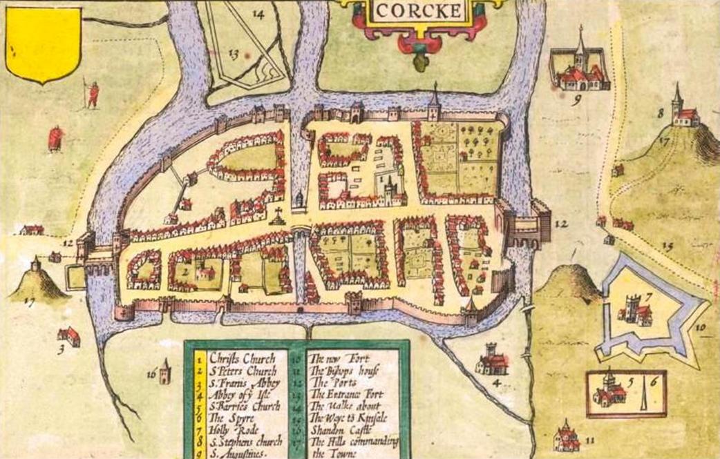
The online map archive of the city through the ages makes for great viewing at www.corkpastandpresent.ie. The early seventeenth century is well represented. One beautifully engraved and hand-coloured map is by John Speed (1552-1629) of the province of Munster taken from The Theatre of the Empire of Great Britaine (1611-12). In the corner of the map is a representation of the walled town of Cork. Though dated 1610 and mentioning London based publishers John Sudbury and George Humble. It was 1616 before it was actually published in Amsterdam by globe maker and map engraver Jodocus II Hondius with the assistance of George Humble, who also acted as Speed’s editor. Sudbury and Humble were the largest and most successful publishers and print-sellers in London.
The Munster map is embellished with an engraving of a man (a cartographer?) wielding a large pair of dividers, while he stands on top of the scale of Irish miles; in Youghal harbour is a galleon ship and in the Atlantic is a boy playing the harp whilst sitting astride a remarkable winged sea creature. Present day Munster comprises six Irish counties but the province has to this day many churches and ancient castles that are depicted on this map. The map abounds with the names of local clans and families – it is inscribed in a very personal way – but its use was also political showing the controlled hidden corners of the British empire.
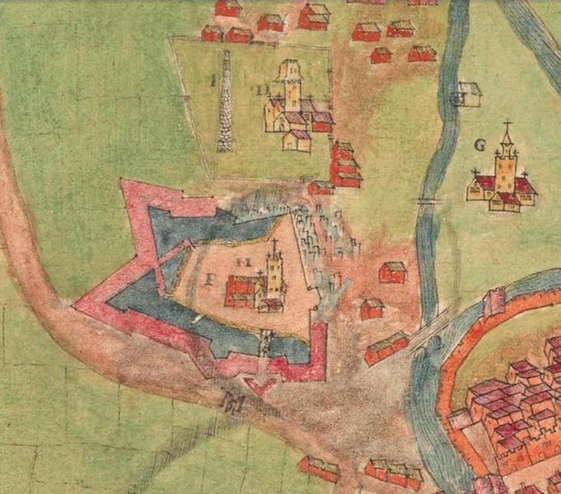
There are two inset town plans on the map of the most prominent towns in the province at the time – Cork and Limerick, both of which were fortified with large town walls and built on rivers. In the Cork map, the northern suburbs, present day Shandon Street is shown along with Shandon Castle and the remains of the Franciscan Abbey on the present day site of the North Mall. In the southern suburbs, structures such as the Augustinian Abbey, the earthen ramparts of Elizabeth Fort, while further west an old medieval church associated with the remains of a round tower encompassed by a wall are depicted.
The Oxford Dictionary of National Biography records that John Speed as beginning his working life as a tailor in the northern English county of Cheshire. He pursued his apprenticeship under his father, a local tailor, and carried on the family business for a number of years. His attention to detail and a keen interest in cartography, led him to try his hand at map making. He began to display a uncharacteristic talent for this and, despite still working as a tailor, Speed created and published his first known map in 1595 – a map of Canaan.
Soon afterwards, Speed was patronised by Sir Fulk Revil, It was this generosity that allowed Speed to depart for London, still as a teenager, and focus on his education at the College of Antiquaries. He became absorbed in his studies, developing his keen interest in history, and soon a specialist interest in the history of cartography. With the help and advice of various associates of Sir Fulk Revil, he pursued the notion of creating a complete and precise atlas of the British Isles.
Speed took the first step with his home county of Cheshire, completing the map with one of the earliest town plans of Chester with arms and vignettes which were to become his signature style. Engraved by William Rogers, this map was published individually in 1604. He continued to cover all the counties of England and Wales. The resulting atlas, finally published in 1612, was titled The Theatre of the Empire of Great Britaine. This remarkable work was published in partnership with the already established house of John Sudbury and George Humble. The atlas, bought by the University Library in 1968, is now considered priceless. It contains a single sheet for each county of England and Wales, plus a map of Scotland and each of the four Irish provinces, and paints a rich picture of the countryside at the turn of the seventeenth century. Cambridge University Library is home to one of only five surviving proof sets. Their map department elegantly describes Speed’s maps: “Rivers wriggle through the landscape, towns are shown as huddles of miniature buildings, woods and parks marked by tiny trees and – with contour lines yet to be invented – small scatterings of molehills denote higher ground”.
The ‘Theatre’ was a great success and was published again many times and by a number of publishers: Sudbury and Humble notably published their second edition of The Theatre in 1627, the last edition to be published before Speed died. In 1627, Speed released his other major work: A Prospect of the Most Famous Parts of the World. This finely detailed and embellished world atlas, the result of many years development alongside The Theatre, includes the notable accolade of being the first world atlas to be published by an Englishman. The Prospect was to be his last major work. John Speed died on 28 July 1629 having created some of the most remarkable cartography.
To be continued…
Captions:
813a. Section of John Speed’s Province of Munster, from Speed’s The Theatre of the Empire of Great Britaine, c.1610-11 (source: Cork City Library)
813b. John Speed’s ‘Corke’ from his Province of Munster (source: Cork City Library)
Kieran’s Our City, Our Town Article, 1 October 2015
Kieran’s Our City, Our Town Article,
Cork Independent, 1 October 2015
Cork Harbour Memories (Part 31)
The Construction of Elizabeth Fort
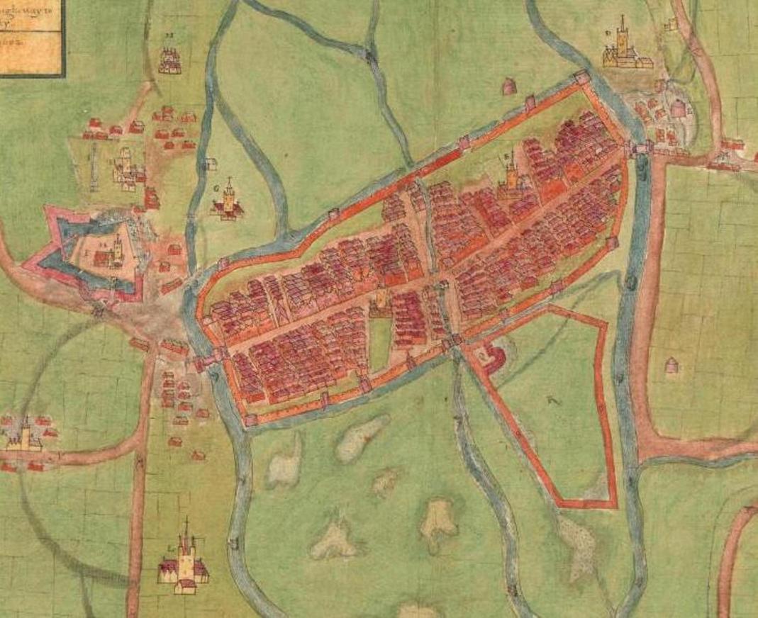
Continuing on to explore the old maps of the City, the colourful Plan of Cork c.1600 based in the Hardiman Collection in Trinity College Dublin places an emphasis on an ordered walled town on a swamp complete with houses, laneways, drawbridges. Commissioned by George Carew, President of Munster or the plantations within the south of the country, this is the second of two known maps of the walled town by him. In this plan the emphasis is less on the height of the walls and more on the roads leading into the settlement. It shows a new dock area to the east to accommodate increased trade. But it is the showcasing of Elizabeth Fort on the left (with the Holy Rood Church within), which is perhaps why this map might of been created.
Due to the stand-off in the Battle of Kinsale between English and Irish and Spanish, a reference in State Papers from late 1601 details Carew paid 200 labourers to expand an extensive trench in the southern suburbs, and that the project was paid by the walled town and the English administration in Ireland. A further reference in the State Papers from Carew to Lord Mountjoy on 6 August 1602 reveals Carew’s interest in creating the large earthwork; “That irregular work your Lordship saw at the south end of Corke, first intended for no other end than a poor entrenchment, for a retreat, is now raised to a great height equal or above all the grounds about it, and so reinforced with a strong rampart, as a powerful enemy shall not carry it in haste, and whilst that work holds out it shall be impossible for an enemy to lodge near that end of the town. The work is great, the Queens charge in erecting it nothing”. References in the same papers also mention the construction of a new fort at Kinsale (in time to become James Fort) and a fort on Haulbowline Island in Cork harbour.
In April 1603, Queen Elizabeth I died and a new protestant king James I was proclaimed. The Council Books of the Corporation of Cork relate that in the case of Cork, a Captain Morgan was given the responsibility by the lord lieutenant of Ireland, Deputy Mountjoy to relate the news. In Cork, the message was received by a George Thornton, one of the Kings’ appointed commissioners for Munster who gave the news to the mayor of Cork, Thomas Sarsfield. In those days, due to previous charters, the mayor and the citizens of any royal town had the choice of refusing to proclaim a new monarch on the English throne but it rarely occurred due to the threat of military force. However, in this case, the mayor, Sarsfield was anti the crown and in favour of the rebellious Irish living in the area. He knew that he could not outright refuse but decided to use niches in the political system to delay the process of proclamation.
Sarsfield took his right to call together elected officials of the Corporation at the city court house to decide on the matter. During this time, he was informed that the rest of the large walled towns had proclaimed James and kept Thornton, the English commissioner who was waiting for a response outside the meeting. Sarsfield managed to delay the process further by declaring that the meeting had to be adjourned until the following day. Under the pressure of time, Sarsfield and the citizens contemplated attacking a fort at Haulbowline but agreed on arming themselves and preventing any English forces from entering the town.
This rebellion did not deter Thornton from carrying out and at this stage enforcing the proclamation that James I was the new king. Thornton and eight hundred soldiers proclaimed the new king in the north suburbs of the city around Shandon Castle. A number of principal characters are recorded in this revolt. One such man, a Thomas Fagan had an interesting personality. One incident involving Thomas included the time he fired a cannon at an Englishman, a James Grant. He had previously attacked Grant and stripped him of his clothes. Fagan was also responsible for breaking into the city’s ammunition store within a former tower house called Skiddy’s Castle. This store was located at the northern end of North Main Street, now the site of the National Rehabilitation Board. However, firing cannons at people, raiding gunpowder stores were only one part of his personality. Fagan also carried a white rod around the city and declared himself the principal church-warden in the city. It is recorded that any English person or protestant that passed him was mocked without fail.
Even, certain Englishmen took the side of the rebels. John Nicholas, brewer and a John Clarke, tanner mounted a small portable cannon on top of the walls and fired at two soldiers, killing them. The town’s recorder, John Mead was also on the side of the rebellion and used his political clout accordingly to support the rebels. Mead ordered the king’s store keeper, an Allen Apsely at Skiddy’s Castle to be killed and his arms to be taken away. He also ordered the arrest of the clerk of the munitions, a Michael Hughes along with his wife who were sentenced to be thrown over the walls as a means of execution.
To be continued…
Captions:
812a. A description of the Cittie of Cork/ Plan of Cork, circa 1602 by George Carew (source: Hardiman Atlas, Library of Trinity College Dublin)
812b. Elizabeth Fort from A description of the Cittie of Cork/ Plan of Cork, circa 1602 by George Carew (source: Hardiman Atlas, Library of Trinity College Dublin)
Cllr McCarthy’s New Book, North Cork Through Time
The second of three books Kieran McCarthy has been involved in penning this year focuses on postcards of historic landscapes of North Cork. Entitled North Cork Through Time, it is compiled by Dan Breen of Cork Museum and Kieran and published by Amberley Press.
The region is defined by the meandering River Blackwater and its multiple tributaries and mountainous terrain to the north. It borders four counties that of Kerry, Limerick, Tipperary and Waterford. The postcards, taken for the most part between c.1900 and c.1920 show the work of various photographers, who sought to capture the region and sell their work to a mass audience. Not every town and village were captured in a postcard. This book brings together many of the key sites of interest and serves as an introduction to the rich history of the region. In the postcards, one can see the beauty that the photographers wished to share and express. The multitude of landmarks shown in this book have been passed from one generation to another, have evolved in response to their environments, and contribute to giving the County of Cork and its citizens a sense of identity and continuity.
Chapter one explores the border territory with County Kerry – a type of frontier territory for Cork people – its history epitomised in the elegant and well-built Kanturk Castle, the gorgeous town of Millstreet with its international equestrian centre and its access into the old historical butter roads of the region. Chapter 2 centres around the Limerick Road from Mallow to Charleville – Mallow a settlement with a heritage dating back 800 years and straddles the winding River Blackwater.
Chapter 3 glances at the area east of the Mallow-Limerick Road taking in the stunning Doneraile estate with the adjacent and spacious streetscape of the connected village. Killavullen, Castletownroche and Kilworth all present their industrial pasts. Mitchelstown stands in the ‘Golden Vale’ of the Galtee Mountains, its heritage being linked back to the Kingston estate and their big house, which dominated the local landscape with views on all it surveyed. Chapter 4 explores Fermoy, which because of its history and connection to a local military barracks possesses a fine range of postcards. Its bridge and weir, views of the Blackwater, the nineteenth century square, colourful streetscapes all reveal the passion for such a place by its photographers. North Cork Through Time by Kieran McCarthy and Dan Breen is available in any good bookshop.
Kieran’s Question to the City Manager/ CE and Motions, Cork City Council Meeting, 28 September 2015
Question to the CE:
To ask the CE on an update on the Penrose Quay hoarding? Whilst acknowledging, the recent creation of a smaller hoarding space, it is now six years since my initial asking of when this remnant of the Cork Main Drainage Project will be completed and the site levelled off (Cllr Kieran McCarthy)
Motions:
To add the footpaths of Oakfield Lawn, Ballinlough Road to the footpath renewal programme (Cllr Kieran McCarthy)
That the Council engage with the European Capital of Innovation programme with a view to attaining such an accolade. The programme celebrates the European city which is building the best “innovation ecosystem”- connecting citizens, public organizations, academia, and business – with a view to helping the city scale up its efforts in this field – all of which Cork and its region have in abundance (Cllr Kieran McCarthy).
Kieran’s Our City, Our Town, 24 September 2015
Kieran’s Our City, Our Town Article,
Cork Independent, 24 September 2015
Kieran’s North Cork Through Time
It’s been a very busy year. The second of three books I have been involved in penning this year focuses on postcards of historic landscapes of North Cork. Entitled North Cork Through Time, it is compiled by Dan Breen of Cork Museum and I and published by Amberley Press.
It is easy to get entangled with the multi-storied landscapes of North Cork. It is a region with so many stories to tell, veins of nostalgic gold from tales of conquest to subtle tales of survival. There are many roads to travel down and many historical spaces to admire. The enormous scenery casts a hypnotic spell on the explorer. The region is defined by the meandering River Blackwater and its multiple tributaries and mountainous terrain to the north. It borders four counties that of Kerry, Limerick, Tipperary and Waterford. The postcards, taken for the most part between c.1900 and c.1920 show the work of various photographers, who sought to capture the region and sell their work to a mass audience. Not every town and village were captured in a postcard. This book brings together many of the key sites of interest and serves as an introduction to the rich history of the region.
In the postcards, one can see the beauty that the photographers wished to share and express. The multitude of landmarks shown in this book have been passed from one generation to another, have evolved in response to their environments and contribute to giving the County of Cork and its citizens a sense of identity and continuity. Cultural heritage does not end at monuments and collections of objects. It also includes traditions or living expressions inherited from our ancestors and passed on to our descendants. Pilgrimages and rituals are also engrained in many of the scenes within the postcards. Even mundane performances can construct a historic past and help weave personal and local memories with established national and regional historical narratives.
In many of the postcards, the scene is set up to elicit a response and to create a certain emotion within us, or because they make us feel as though we belong to something – a region, a country, a tradition, a way of life, a collective memory, a society. North Cork is blessed with such an array of diversity in heritage sites and there is a power in that diversity.
Chapter one explores the border territory with County Kerry – a type of frontier territory for Cork people – its history epitomised in the elegant and well-built Kanturk Castle, the gorgeous town of Millstreet with its international equestrian centre and its access into the old historical butter roads of the region, the use of secondary rivers for transport and industry, and the development of railways lines.
Chapter 2 centres around the Limerick Road from Mallow to Charleville – Mallow a settlement with a heritage dating back 800 years and straddles the winding River Blackwater. The town came into its own in the nineteenth century with the development of its main street, churches, academies, convents, viaduct, clock tower and spa house, all interwoven with the commemoration of Ireland’s famous writer and poet, Thomas Davis. The idea of an interwoven and multi-narrative heritage is also present in Buttevant. A former walled town, its medieval fabric is shown in its streetscape and old tower, Franciscan church and the ruinous Ballybeg Abbey in the town’s suburbs. On the latter site its columbarium or pigeon house reminds the visitor of the importance of seeing the human side of our heritage – that people minded the birds and in a cherished way created the house with all its square roosts. Charleville also connects to an English colonial past being a late seventeenth century plantation town named after Charles II.
Chapter 3 glances at the area east of the Mallow-Limerick Road taking in the stunning Doneraile estate with the adjacent and spacious streetscape of the connected village. Killavullen, Castletownroche and Kilworth all present their industrial pasts. Along the Blackwater, Ballyhooley Castle stands in defiance of time, as does Moorepark and Glanworth Castles, just off the old Fermoy-Mitchelstown Road. The nineteenth century estates are very prevalent in old stone walls, old ruinous and rusted gateways. There are exceptions such as Castlehyde, which stands as a testament to the affection of the Flatley family, the current guardians of its heritage, but also a salute to the many families who inherited such estates and landscapes. Mitchelstown stands in the ‘Golden Vale’ of the Galtee Mountains, its heritage being linked back to the Kingston estate and their big house, which dominated the local landscape with views on all it surveyed.
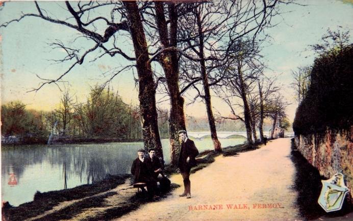
Chapter 4 explores Fermoy, which because of its history and connection to a local military barracks possesses a fine range of postcards. Its bridge and weir, views of the Blackwater, the nineteenth century square, colourful streetscapes all reveal the passion for such a place by its photographers. Still today, you can almost hear the hoof noises and creaking carriage wheels of the Anderson coach works and the marching of the military in the now disappeared army barracks. Above all Fermoy through its heritage exhibits a strong sense of place, a proud settlement, traits which pervade across North Cork and its landscape.
North Cork Through Time by Kieran McCarthy and Dan Breen is available in any good bookshop.
Captions:
810a. Banks of River Blackwater at Fermoy, c.1910 (source: Cork City Museum).
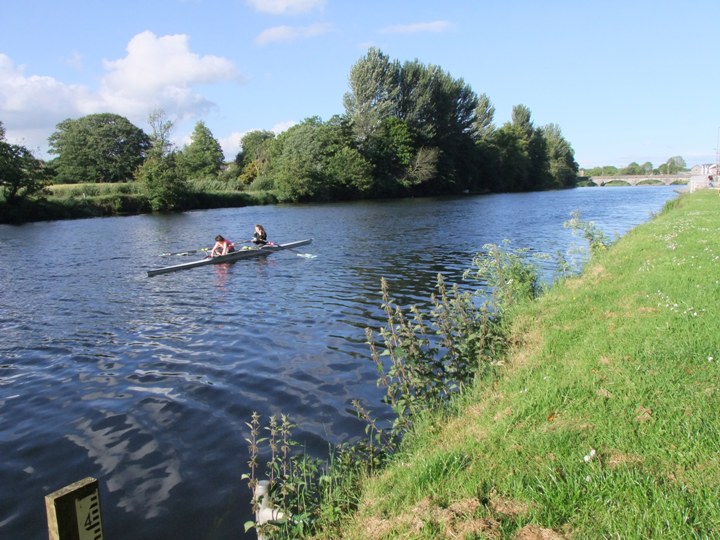
810b. Banks of River Blackwater at Fermoy, present day (picture: Kieran McCarthy)
Kieran’s Our City, Our Town, 17 September 2015
Kieran’s Our City, Our Town Article,
Cork Independent, 17 September 2015
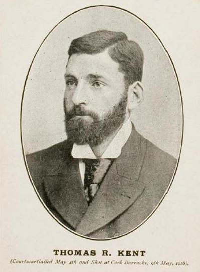
Thomas Kent Returns Home
The north Cork village of Castlelyons will come to a standstill on this Friday as it finally welcomes home the remains of Thomas Kent, who along with Roger Casement was the only person outside of the capital to be executed in the aftermath of the 1916 Rising. Following his execution by firing squad at Cork Prison on 9 May 1916 Thomas Kent’s remains were interred in an unmarked grave within the prison compound.
For almost a century the exact location of his resting place remained a mystery. His family had long campaigned for Thomas’ grave to be identified so that he could be re-interred at the family plot in Castlelyons. This became possible after documents, kept secret by the British for almost a century, were released identifying his grave. Remains exhumed following an exhaustive investigation led by the National Monuments Service subsequently underwent DNA testing by the State Pathologists Office, the Garda Technical Bureau and the UCD Science Faculty and were confirmed to be those of Thomas Kent. The Kent family subsequently accepted an offer by An Taoiseach Enda Kenny of a State funeral for Thomas, which will take place in his native Castlelyons on Friday. On this Thursday evening his remains will arrive to the chapel in Cork’s Collins Barracks. Following a private family sitting, there will be a prayer service, which will be open to the public, from 6.30pm. The chapel will remain open after the service to allow people to pay their respects. On Friday the funeral cortège will depart from Cork Prison with full military accompaniment following a private removal service.
The online exhibition of of the National Library’s 1916 Rising, Personalities and Perspectives outlines that Thomas Kent was born in Bawnard House, Castlelyons, Co. Cork in 1865. His family had a long tradition of fighting against the injustices suffered by small farmers and fought particularly during the Land War. When Thomas was 19 he emigrated to Boston where he settled for some years working as a church furniture maker until he was forced to return to Cork due to ill health.
Upon his return he spent some months in prison for his involvement in land reform agitation. It was not unusual for a Kent brother to be in jail and the Royal Irish Constabulary spent much time pursuing and keeping under observation the Kent household. After the split in the Nationalist movement due to the Parnell affair the family seem to have slowed their involvement until Thomas joined the Gaelic League and soon afterwards the Irish Volunteers when they were established in 1913.
John Redmond, the recruiting sergeant for the British Army and leader of the Home Rule Party was due to give an oration in the village of Dungourney. The Kent brothers invited Terence MacSwiney to speak on an anti-recruitment platform at the same time. The local GAA members and Volunteers marched through Redmond’s meeting holding their hurleys on their shoulders in simulation of rifles. That evening a company of Irish Volunteers was created in Dungourney much to the consternation of Redmond and the local police. It was only a few weeks after this that the police arrested and remanded Thomas. Despite their best efforts he was found not guilty but the police raided Bawnard House a few days after his release and discovered weapons and ammunition. Thomas Kent was sent to prison again, this time for two months.
Later, when news of the Rising in Dublin reached the Kent brothers they lingered in some neighbouring houses for orders to mobilize. These orders never came due to MacNeill’s countermanding order and to the fact that J J O’Connell came to Cork with the order to stand down. By 2 May, four of the brothers, Thomas, William, Richard and David returned to Bawnard House. At dawn, the police came to the house with orders to arrest the whole family. They had encircled the house and called for the four brothers to come outside. Thomas replied that they were soldiers of the Irish Republic and that there would be no capitulatation. To this the police replied with a volley of shots. For the next three hours a battle followed but the Kent’s, with only three shotguns and one rifle to their name, ultimately ran out of ammunition. Mrs. Kent was in the house throughout the battle and not only gave great encouragement to her sons but helped to clean and cool their weapons.
The outcome of the fight was that one of the brothers David was wounded and a Head-Constable was killed. In the confusion of the Kent’s surrender, the athletic Richard made a dash for the woods rather than return to prison. He was killed in a fusillade of RIC rifle fire. The constables put the two remaining brothers who could stand up, against a wall, and were going to shoot them but for the intervention of a military officer. On 4 May, William and Thomas were court-martialed. William was acquitted but Thomas was convicted and sentenced to death for taking “part in an armed rebellion…for the purpose of assisting the enemy”. Thomas Kent was executed by the British in Cork Detention Barracks on 9 May 1916.
Captions:
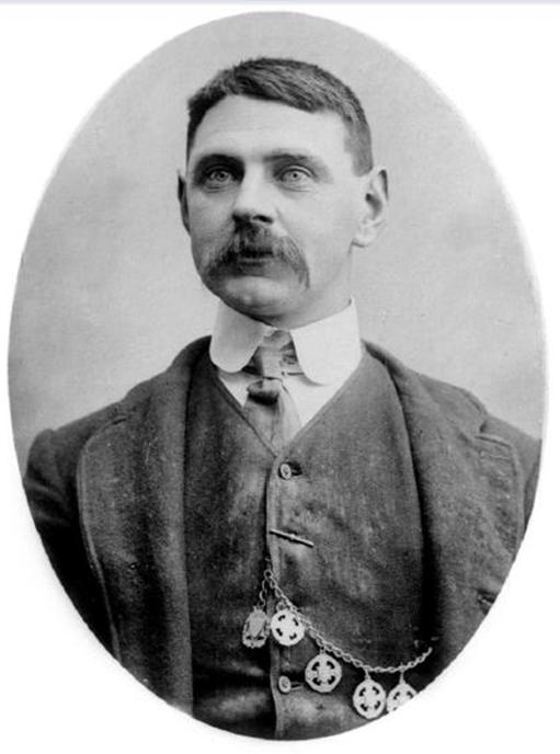
810a. Thomas Kent (picture: National Library of Ireland)
810b. Richard Kent (picture: National Library of Ireland)
Kieran’s Question to the City Manager/ CE and Motions, Cork City Council Meeting, 14 September 2015
Question to the CE:
To ask the CE for an update on the Blackrock regeneration pier project and the work to be pursued very shortly? (Cllr Kieran McCarthy)
Motions:
That the Council engage with the European Region of Gastronomy Programme with a view to attaining such an accolade. The European Region of Gastronomy Award is given to regions that commit to a programme of events designed to promote distinctive food cultures, educate for better health and sustainability, and who stimulate gastronomic innovation – the latter of which Cork and its region have in abundance (Cllr Kieran McCarthy).
That a sustainable programme of work be put in place to tidy up (overgrowth, fallen stones, broken wrought iron work) the nineteenth century parts of St Joseph’s Cemetery, which are in a dreadful state. Can the Council work with the Prison service and the community work scheme to keep such historic spaces tidy? (Cllr Kieran McCarthy).
Kieran’s Our City, Our Town, 12 September 2015
Kieran’s Our City, Our Town Article,
Cork Independent,
Discover Cork: Schools’ Heritage Project 2015-16
10 September 2015
This year coincides with the thirteenth year of the Discover Cork: Schools’ Heritage Project. Again launched for the new school term, the Project is open to schools in Cork; at primary level to the pupils of fourth, fifth and sixth class and at post-primary from first to sixth years. There are two sub categories within the post primary section, Junior Certificate and Leaving Certificate. A student may enter as an individual or as part of a group or a part of a class entry.
Co-ordinated by myself, one of the key aims of the project is to encourage students to explore, investigate and debate their local heritage (built, archaeological, cultural and natural) in a constructive, active and fun way. Projects on any aspect of Cork’s rich heritage can be submitted to an adjudication panel. Prizes are awarded for best projects and certificates are given to each participant. A cross-section of projects submitted from the last school season can be gleamed from this link on my website, www.corkheritage.ie where there are other resources, former titles and winners and entry information as well.
Students produce a project on their local area using primary and secondary sources. Each participating student within their class receives a visit and workshop in October 2015. The workshop comprises a guide to how to put a project together. Project material must be gathered in an A4/ A3 size Project book. The project may be as large as the student wishes but minimum 20 pages (text + pictures + sketches). Projects must also meet five elements. Projects must be colourful, creative, have personal opinion, imagination and gain publicity before submission. These elements form the basis of a student friendly narrative analysis approach where the student explores their project topic in an interactive and task oriented way. In particular students are encouraged to attain material through visiting local libraries, engaging with fieldwork, interviews with local people, making models, photographing, cartoon creating, making DVDs of their area. Re-enacting can also be a feature of several projects.
For over thirteen years, the project has evolved in how students actually pursue local history. The project attempts to provide the student with a hands-on and interactive activity that is all about learning not only about heritage in your local area (in all its forms) but also about the process of learning by participating students. The project is about thinking about, understanding, appreciating and making relevant in today’s society the role of our heritage- our landmarks, our oral histories, our scenery in our modern world for upcoming citizens. So the project is about splicing together activity on issues of local history and heritage such as thinking, exploring, observing, discovering, researching, uncovering, revealing, interpreting and resolving. This year as well there is a focus on the 1916 commemoration side with projects on the centenary being encouraged.
The importance of doing a project in local history is reflected in the educational aims of the history curricula of primary and post-primary schools. Local heritage is a mould, which helps the student to become familiar with their local environment and to learn the value of it in their lives. Learning to appreciate the elements of a locality, can also give students a sense of place in their locality or a sense of identity. Hence the Project can also become a youth forum for students to do research and offer their opinions on important decisions being made on their heritage in their locality and how they affect the lives of people locally. Over the years, I know a number of students that have been involved in the project in schools over the years who have took their interest further and have gone on to become professional tour guides, and into other related college work.
The project is open to many directions of delivery. Students are encouraged to engage with their topic -in order to make sense of it, understand and work with it. Students continue to experiment with the overall design and plan of their work. For example in general, students who have entered before might engage with the attaining of primary information through oral histories. The methodologies that the students create provide interesting ways to approach the study of local heritage. Students are asked to choose one of two extra methods (apart from a booklet) to represent their work. The first option is making a model whilst the second option is making a DVD. It is great to see students using modern up todate technology to present their findings. This works in broadening their view of approaching their project.
This project in the City is kindly funded by Cork City Council (viz the help of Niamh Twomey), the Heritage Council and Cork Civic Trust (viz the help of John X. Miller). Prizes are also provided by the Lifetime Lab, Lee Road and Sean Kelly of Lucky Meadows Equestrian Centre, Watergrasshill (www.seankellyhorse.com). There is also a County Cork edition. Overall, the Schools’ Heritage Project for the last thirteen years has attempted to build a new concerned generation of Cork people, pushing them forward, growing their self-development empowering them to connect to their world and their local heritage. Spread the word please.
Captions:
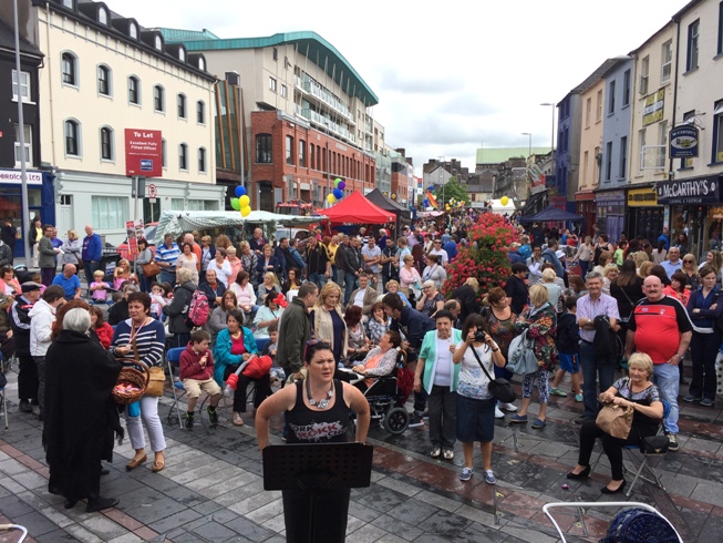
809a. Deirdre Moriarty getting ready to prepare the Rokk Choir at the recent Coal Quay Festival (picture: Kieran McCarthy).
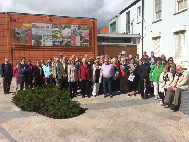
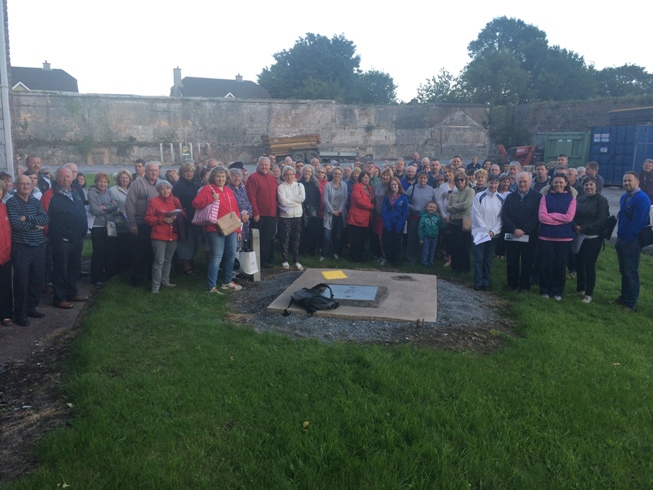
809b. A walking tour getting underway at Elizabeth Fort during the recent Cork Heritage Open Day (picture: Kieran McCarthy)

Pictures, Kieran’s Heritage Week 2015
Thanks to everyone who recently supported my heritage week tours 🙂
Old workhouse at St Finbarr’s Hospital, Douglas Road (24 August 2015)
Historical walking tour of Turners Cross and Ballyphehane (26 August 2015)

Historical walking tour of Sunday’s Well (27 August 2015)
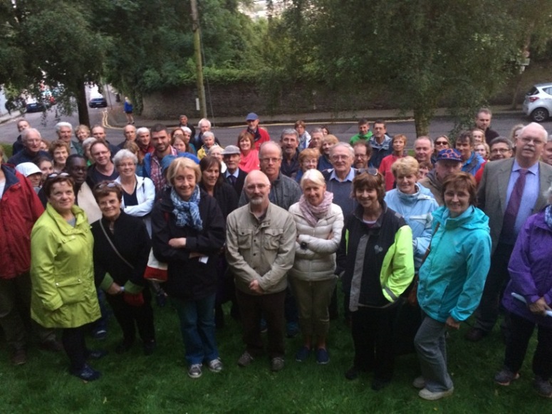
Historical walking tour of Fitzgerald’s Park (28 August 2015)