Kieran’s Our City, Our Town, 3 September 2015

808a. Front cover of Kieran McCarthy's new book, Little Book of Cork

Kieran’s Our City, Our Town Article,

Cork Independent, 3 September 2015

Kieran’s Little Book of Cork


   The Little Book of Cork is a new book penned by myself and published by History Press Ireland. It aims to be compendium of fascinating, obscure, strange and entertaining facts about Cork City. Here you will find out about Cork’s buildings and businesses, its proud sporting heritage, its hidden corners and its famous (and occasionally infamous) men and women. Through its bustling thoroughfares and down winding laneways, this book takes the reader on a journey through Cork and its vibrant past, recalling the people and events that shaped this great city. A reliable reference book and a quirky guide, this can be dipped into time and time again to reveal something new about the people, the heritage and the secrets of Cork.

     The book has nine chapters. This book begins by delving into the multiple phases of Cork’s development, its tie in to wider Irish history and to a degree how Cork branded itself through the centuries. From the creation of the first port, the city’s coat of arms, to building international confidence as one of the self-proclaimed Venices of Northern Europe, Cork’s historical development and ambition knew no bounds! However, certainly colonists such as the Vikings and Anglo-Normans and immigrant groups (and eventually citizens in their own right) such as Huguenots and Quakers led the settlement to have a role in the wider North Atlantic trade and beyond. All were involved in physically altering the townscape, constructing new buildings and quays and improving the interface with the river and the sea. Some key events such as Cork’s role in the Irish War of Independence in the early twentieth century also led to changes to the city’s fabric. The Burning of Cork incident led to many of its main street buildings, City Hall and Library being destroyed. The city rose from the ashes with a rebuild plan plus also strategies for the growing population and their requests for new housing areas.

    Chapter 2 focuses on the array of public spaces and buildings that the city possesses. You can get lost in and around the multiple narrow streets and broad thoroughfares. Every corner presents the visitor with something new to discover. The pigeonfilled medieval tower of the Augustinian Red Abbey and the ruinous room of an old Franciscan well are rare historical jigsaw pieces that have survived the test of time. The dark dungeon at Blackrock Castle, with its canon opes, dates back to 1585 whilst the star-shaped structure of Elizabeth Fort has stonework stretching way back to the early seventeenth century. The city does not have much eighteenth century built heritage left. What does exist such as the Queen Anne ‘Culture House’ on Pope’s Quay, represents an age where Dutch architecture was all the rage. A high pitched roof and elaborate and beautiful brickwork combines to make a striking structure. The legacy of the city’s golden age of markets is present in the English Market, written about and critiqued since 1788.

    Many architects have come and gone over the centuries but the rivalry of The Pain Brothers and the Deane family in the early nineteenth century inspired both families to excel in the design of some of the most gorgeous stone-built buildings from banks to churches to the quadrangle of University College Cork (UCC). All were embellished with local limestone, which on a sunny day, when the sun hits such a stone, lights up to reveal its splendour and the ambition of Ireland’s second city. The settlement is also a city of spires linking back 1,400 years to the memory of the city’s founding saint, Finbarre. The old medieval churches of St Peter and Christ Church are now arts centres but many elements of their ecclesiastical past can be glimpsed and admired. Couple these with the beautiful St Anne’s Church tower and the scenery from the top of its pepper pot tower, the nineteenth-century splendour of the spires and stained glass of St FinBarre’s Cathedral and the sandstone block work of SS Mary’s and Anne’s North Cathedral, and the visitor can get lost in a world of admiration and wider connections to global religions. Then there is the determination that led the city to also possess the longest building in Western Europe – the old Cork Lunatic Asylum or Our Lady’s Hospital and the tallest building in the country – County Hall, and only in recent years surpassed by the Elysian Tower.

    Then there are the buildings which belong to the people. The current City Hall, the second building on the site, is the home of Cork City Council, formerly Corporation, which was established in Anglo-Norman times. The building is a memorial to the first building, which burned down in 1920, and to the memory of two martyred lord mayors, Terence McSwiney and Tomás MacCurtain. Terence died on a hunger strike and Tomas was shot in his house in Blackpool, both dying for the Irish War of Independence cause. The train station, Kent Station, also links through its name to Irish Easter Rising martyr, Tomas Kent. The station is the last of six railway stations, which travelled out into the far reaches of County Cork.


The Little Book of Cork is available in any good bookshop.


 Captions:

 808a. Front cover of Little Book of Cork (2015) by Kieran McCarthy, published by History Press, Ireland.

 808b. Re-enactors at Elizabeth Fort, recent Cork Heritage Open Day


808b. Re-enactors at Elizabeth Fort, recent Cork Heritage Open Day

Kieran’s Our City, Our Town, 27 August 2015

807a. Interior of St Vincent's Church

Kieran’s Our City, Our Town Article,

Cork Independent,  27 August 2015

Kieran’s Heritage Week Tours, 22-30 August 2015


We’re into the final few days of National Heritage week. I have two tours left this week:

Friday 28 August 2015 – Cork’s Elegant Suburb, historical walking tour of Sunday’s Well, meet at St Vincent’s Bridge on the North Mall side, 7pm (free, duration: two hours).

Saturday 29 August – Park Stories, Historical walking tour of Fitzgerald’s Park, meet at band stand in park, 2pm (free, duration: two hours).

   With regard to the Sunday’s Well tour, I am a big fan of St Vincent’s Church. The site of the church was donated to the Vincentian Fathers by a Miss Mary Mac Swiney of Sunday’s Well. The plans for the church were prepared by Sir John Benson whose other works, included the building of thirty bridges in County Cork, the re-construction of the North Gate Bridge, the city’s Athenaeum which was later converted into the Opera House, just to mention a few. The original plans of the church were to be dominated by a large ornate spire. However, owing to its cost of construction, it was not incorporated into the building. Instead, twin turrets were added.

    The proposals also set out designs for the building of a house for missions and retreats. The funds were collected by the very Rev. Michael O’ Sullivan, who was Vicar-General of the Diocese at the time and who had become a Vincentian on 1 February, 1848. The foundation stone was laid on 24 October 1851 on the Feast of St Raphael, by Rev. Dr. Delaney, Bishop of the Diocese. Two years later in 1853, disaster struck. The walls had now been built and the church was partially roofed, when a terrible catastrophe occurred. On 4 November 1853, a powerful storm swept away the roof and stonework. This provoked the sympathy and support of the people of Cork and many friends in the south of Ireland. At a public meeting in the city, the Vincentians collected £700. A bazaar was organised by the Ladies of Charity of St. Vincent de Paul and this raised £600. The Archdiocese of Dublin sent £100 and the dioceses of Munster also sent a large contribution. Subsequently, the church was soon re-built and opened.

   On 20 July, 1856, St. Vincent’s was re-dedicated. Dr. Delaney performed the ceremony and celebrated the Solemn High Mass while the sermon was said by the most Rev. Dr. Dixon, Archbishop of Armagh. The Archbishop of Dublin and seven bishops were present. The church itself was only consecrated on 14 October 1906. The old High Altar, which has been replaced by a modern liturgical altar, was of marble and Caen Stone. The Tabernacle was surrounded by a decorative canopy and spire. Today, a small ornate altar exists.

    The Passion Altar is also of Caen stone and varied marbles. The story of the Passion is carved behind the altar. The left hand side altar (facing the main altar) displays the Pieta, Mary holding Christ in her arms. The right hand side altar is dedicated to Mary, mother of Christ and is comprised of Cobh and Midleton Marbles, with Connemara green. This contrasts well to the rest of the Church’s silican white, black and gold marble. It was in the 1960s that the old High Altar was changed to a new more modern altar.

   One of the main features of St Vincent’s Church is its stained glass windows. For example, the eastern window has the Blessed Virgin in the centre; St Joseph and St Patrick stand on her right and on her left hand, St Vincent and St FinBarre. The rest of the window represents the life of St Vincent. Another feature is the organ, which was originally built by Messrs Telford, Dublin in 1859. This was divided into two sections by Messrs Magahy and Son, Cork, in 1904.

   The sacristy was a gift from Fr Sean Campell C.M., was opened in 1900 and is composed of two pictures, St. Patrick and St. FinBarre on its side walls. Both are of the Munich School of Art. The Stations of the Cross were presented in 1856, to the most Rev. Dr. Gilooly, Bishop of Elphin, who as a young priest worked as a builder of St. Vincent’s Church. Indeed, it is noted that the main body of the church was not completed until 1886 under the direction of new plans by Samuel F Hynes. Hynes was part of a wider group of late nineteenth-century architects employed to create new symbolism for the Catholic Church which was growing in strength since the passing of the Catholic Emancipation Act in 1829. Hynes was an architect of great experience, and had been involved in the re-building or design of additions in several churches within the Cork area and wider afield. He re-interpreted a smaller version of Cormac’s Chapel for Gougane Barra. Samuel Hynes, who completed much work for the Diocese of Cork and further afield. He was involved in the design of eight churches over a sixteen year period. The eight churches, somewhat similar in design, created a forum for engaging with the Catholic Church and its character.


Captions:

807a. Interior of St Vincent’s Church (picture: Kieran McCarthy)

807b. Samuel Hynes, architect, who prepared the plans to finish off the interior of St Vincent’s Church in 1886 (source: Cork City Library)

807b. Samuel Hynes

Kieran’s Our City, Our Town, 20 August 2015

806a. Capwell Road circa 1927

Kieran’s Our City, Our Town Article,

Cork Independent,  20 August 2015

Kieran’s Heritage Week Tours, 22-30 August 2015


     National Heritage Week is upon us again at the end of next week (22nd – 30th August). It’s going to be a busy week. For my part I have set up a number of events. They are all free and I welcome any public support for the activities outlined below. There are also brochures detailing other events that can be picked up from Cork City Hall and Libraries.

    Cork Heritage Open Day, Saturday 22 August 2015 – Historical Walking Tour of Cork City Hall; Learn about the early history of Cork City Council; discover the development of the building and visit the Lord Mayor’s Room, 11am, free but ticketed, contact The Everyman Palace, 0214501673 (duration: 75 minutes). The current structure, replaced the old City Hall, which was destroyed in the ‘burning of Cork’ in 1920. It was designed by Architects Jones and Kelly and built by the Cork Company Sisks. The foundation stone was laid by Eamonn de Valera, President of the Executive Council of the State on 9 July 1932 (www.corkheritageopenday.ie).

 Monday 24 August 2015 – Tales of the City’s Workhouse, historical walking tour, meet at entrance to St Finbarr’s Hospital, Douglas Road, 7pm (free, duration: two hours).

    The Cork workhouse, which opened in December 1841, was an isolated place – built beyond the toll house and toll gates, which gave entry to the city and which stood just below the end of the wall of St. Finbarr’s Hospital in the vicinity of the junction of the Douglas, and Ballinlough Roads. The Douglas Road workhouse was also one of the first of over 130 workhouses to be designed by the Poor Law Commissioners’ architect George Wilkinson.

 Wednesday 26 August 2015 – From Market Gardens to Architectural Eminence, historical walking tour of Turners Cross and Ballyphehane, meet at entrance to Christ the King Church, Turners Cross, 7pm (free, duration: two hours).

     This is a new tour that hopes to bring the participant from the heart of Turners Cross through to Ballyphehane. The tour will speak about housing developments in the 1920s through to the 1950s but also touch upon the earlier history of the two areas from Friars Walk, the story of the Botanic Garden, Christ the King Church to some information on the market gardens. All are welcome and any old pictures and documents that people on these areas, please bring along.

    From a social housing perspective in March 1925, Commissioner Philip Monahan pitched that he would invest £70,000 for the provision of 200 houses in Turners Cross in the immediate interim. He also put down his marker that he was to build efficiency in the local public sector. Indeed with the threat of using direct labour, he pursued an agenda to reduce the wage of Corporation workers to 4s. 6d. per week. In the summer of 1925, property was acquired by Cork Corporation in what was to become known as the Capwell Project by deed of transfer from Richard Morgan. In the Christmas of 1925, 20 men were employed on relief work for 2/3 weeks clearing the site, preparatory to the actual building. By April 1928, 148 houses were ready for occupation by tenants. During the construction of Capwell Housing, on 19 March 1926, further property for housing was acquired from Abina Hyde in a deed of transfer to Cork Corporation. In late September 1926, during a luncheon of Cork Rotary Club, Philip Monahan proposed to raise a loan of £100,000 for a further 200 houses in Turners Cross. In June 1929, applications were invited from intending occupiers.

Friday 28 August 2015 – Cork’s Elegant Suburb, historical walking tour of Sunday’s Well, meet at St Vincent’s Bridge on the North Mall side, 7pm (free, duration: two hours).

    This new walking tour begins on the gorgeous North Mall and explores the area’s medieval origins and the Franciscan North Abbey. In such a small corner of the city, industrial Cork and the story of the distilling can be told, as well as stories of George Boole, St Vincent’s Bridge. Walking along Sunday’s Well there are multiple stories to be told of former residents and of the beautiful St Vincent’s Church.

 Saturday 29 August – Park Stories, Historical walking tour of Fitzgerald’s Park, meet at band stand in park, 2pm (free, duration: two hours)

   Looking at the physical landscape of the Park, there are clues to a forgotten and not so familiar past. The entrance pillars on the Mardyke, the Lord Mayor’s Pavilion, the museum, the fountain in the middle of the central pond dedicated to Fr Mathew and timber posts eroding in the river were once part of one of Cork’s greatest historical events, the Cork International Exhibitions of 1902 and 1903. Just like the magical spell of Fitzgerald’s Park, the Mardyke exhibitions were spaces of power. Revered, imagined and real spaces were created. They were marketing strategies where the past, present and future merged; aesthetics of architecture, colour, decoration and lighting were all added to the sense of spectacle and in a tone of moral and educational improvement. The entire event was the mastermind of Cork Lord Mayor Edward Fitzgerald, after which the park got it name.

Hope to see you on some of these tours…

Captions:

806a. During construction, Capwell Road, circa 1927 (source: Cork City Library)

806b. Summer sunshine in Fitzgerald’s Park (picture: Kieran McCarthy)


806b. Summer sunshine in Fitzgerald’s Park


Kieran’s Our City, Our Town Article, 13 August 2015

805a. Beautiful and imposing building, 66 AIB, South Mall

Kieran’s Our City, Our Town Article,

Cork Independent13 August 2015

Cork Heritage Open Day 2015


   Another Cork heritage open day is looming. The 2015 event will take place on Saturday 22 August. For one day only, nearly 40 buildings opened their doors free of charge for this special event.  Members of the public are allowed a glimpse of some of Cork’s most fascinating buildings ranging from the medieval to the military, the civic to the commercial and the educational to the ecclesiastical. This event was greeted with great enthusiasm by building owners and members of the public alike in 2014 with an estimated 25,000 people participating in the day.

   It is always a great opportunity to explore behind some of Cork’s grandest buildings. With the past of a port city, Cork architecture is varied and much is hidden amongst the city’s narrow streets and laneways. Much of its architecture is also inspired by international styles – the British style of artwork pervading in most cases– but it’s always pays to look up in Cork and marvel at the Amsterdamesque-style of our eighteenth century structures on streets such as Oliver Plunkett Street or at the gorgeous tall spires of the city’s nineteenth-century churches.

    Cork Heritage Open Day is eleven years in the making and with 40 buildings it is almost impossible to visit them all in one day. It takes a few goes to get to them all and spend time appreciating their physical presence in our city but also the often hidden context of why such buildings and their communities came together and their contribution to the modern day picture of the city. The team behind the Open Day do group the buildings into general themes, Steps and Steeples, Customs and Commerce, Medieval to Modern, Saints and Scholars and Life and Learning – one can walk the five trails to discover a number of buildings within these general themes. These themes remind the participant to remember how our city spreads from the marsh to the undulating hills surrounding it, how layered the city’s past is, how the city has been blessed to have many scholars contributing to its development and ambition in a variety of ways and how the way of life in Cork is intertwined with a strong sense of place.

    The trail Steps and Steeples is a very apt way to describe the topography of our city. The Steps and Steeples walk encompasses not only some of the amazing buildings on the North Side of the city, but also some of the most spectacular views. Admire the frontage of the Cork Baptist Church on McCurtain Street, re-examine the crooked but limestone inspiring spire of Cork Trinity Presbyterian Church, gorge on the stained glass windows of St Luke’s Church, re-imagine past hospital treatment at the Ambassador Hotel, revel in how many barrels of beer have been exported from the former Murphy’s Brewery, now Heineken Ireland, reminisce of Cork’s North Infirmary at the Maldron Hotel, attempt to count how many barrels of butter were weighed at the Firkin Crane, ring the bells of St Anne’s Church, Shandon Military and read up about the military history underlining the city’s and harbour’s development.

    Open for Heritage Open Day, the military museum at the Barracks has three themes – the history of the Barracks, Michael Collins and Peacekeeping. The core collection consists of memorabilia associated with Michael Collins and also has displays from donated private collections. The Heritage Day brochure remarks that the Barracks building is a fine example of Georgian Architecture. It is also significant from a historic perspective. The fine limestone gateway has been the focal point of historic events in Ireland since the time of the Crimean War in 1856 with the return of the 17 Lancers after the Battle of Balaclava. It was the location for the handing over of the Barracks from the British Government to Commandant Sean Murray of the Irish Army in 1922, and was visited by President Kennedy in 1963.

   Meanwhile down by the river, the Customs and Commerce walk follows the Lee and showcases some of the old and new commercial buildings in the city. These buildings track the commercial history of Cork City and highlight its many industries over time. For the more energetic walker this route can be combined with the Medieval to Modern walking route. Re-imagine the turning of the wheels of the trams at the National Sculpture Factory, learn about local government in the City Hall, think highly of the multiple stories of the city’s masons and carpenters at the Carpenter’s Hall, feel the energy of the steam ships in the maritime paintings in the city’s Custom House, and look at the fine details on the pillars within AIB Bank on the South Mall. The flagship AIB Bank, former Munster and Leinster bank building at 66 South Mall, designed by Henry Hill, celebrates its centenary this year. It is an iconic nine bay 3 storey building, built between 1909 to 1914, in the heart of the financial district of Cork.  It is Edwardian – Italinate in style. The distinctive building façade is in stunning local silver limestone, and the main façade upper floors are articulated by giant order fluted lonic columns – very striking and beautiful indeed.

See www.corkheritageopenday.ie for more information on the city’s great heritage day and then followed by Heritage Week.

Captions:

805a. Beautiful and imposing building, 66 AIB, South Mall (picture: Kieran McCarthy)

805b. Interior of 66 AIB, South Mall at this year’s launch of the Cork International Choral Festival (picture: Kieran McCarthy)


805b. Interior of 66 AIB, South Mall at this year’s launch of the Cork International Choral Festival

Kieran’s Our City, Our Town, 6 August 2015

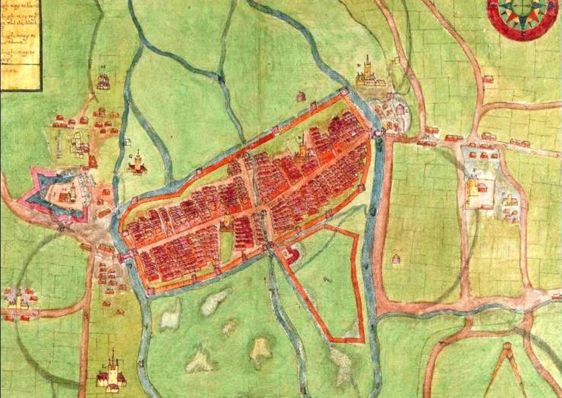
804a. Map of Cork, late sixteenth century as depicted in Sir George Carew’s Pacata Hibernia


Kieran’s Our City, Our Town Article, 

Cork Independent, 6 August 2015

Cork Harbour Memories (Part 30)

Colonising a Swamp


    President of the Munster Plantation George Carew’s Map of Cork circa 1600 shows the town wall of Cork encompassing an oval shaped settlement on a swamp. His emphasis is on showing off the infrastructure. He depicts the town as a spacious, strong and prominent settlement, complete with the protection of drawbridges and the eastern portcullis gate called Watergate. The mechanics of raising up of such structures must have got damp and noisy, must have creaked, and must have irked the visitors to the town. Maybe many of the citizens didn’t hear those sounds, being so used to them. The town was there for several centuries. Access was through these points and people were used to their everyday function in giving and refusing access to the town.

    The walled defences, 1,500 metres in circumference, were to provide security for its inhabitants up to 1690. They also controlled light and shade, the wall overlooked and in a sense organised the lives of citizens. On the map, the buttress walls and its drawn lines that rise from the marshy ground give the structure a striking strength and depth of foundation, physically, spatially and culturally. The hardness and indestructibility of the stone has a noble look to it and fitted Carew’s idea and vision of a colonised landscape. Much of the town wall survives beneath the modern street surface and in some places has been incorporated into existing buildings. Carew presents a wall on his map almost mass concrete looking – as in he doesn’t show the reality of the use of multiple stones in its construction– as seen in the wall on display in Bishop Lucey Park. The wall comprised two stone types, limestone and sandstone,. The engineering involved in its construction was substantial. The citizens must have had problems in laying foundations into the swamp. Their timber scaffolding must have collapsed at times. The courses of the stone must have collapsed. It was a jig-saw puzzle in its construction.

     In a present day context, echoes of the ground plan of the walled town survive. If one starts on the corner of the Grand Parade and the South Mall, on the city library side, the walls of the medieval town would have extended the full length of the Grand Parade, along Cornmarket Street, onto the Coal Quay, up Kyrl’s Quay to the North Gate Bridge. From here they would have extended up Batchelor’s Quay as far as Grattan Street, then turning southwards, the walls would have followed the full length of present day Grattan Street as far as present day Clarke’s Bridge. The walls then followed the course of the River Lee back to the starting point.

     Some of the wealthier merchants formed the corporation and lived in tower houses or large two to three storey castle-like structures. They were as important as the infrastructure and many were the key agents of governance for centuries. These families included the Roches, Skiddys, Galways, Coppingers, Meades, Goulds, Tirrys, Sarfields, and the Morroghs. Their names were all involved in the running of the town from its inception in the late 1100s to the seventeenth century. They also controlled large portions of Cork’s trade and rented out numerous plots of land to other citizens – Irish natives and English colonialists. Carew’s depiction shows two tower houses within the precincts of the medieval core, Skiddy’s Castle and Roche’s Castle. Skiddy’s Castle was located in the north east sector of the town over-looking North Main Street, close to North Gate Drawbridge while Roches Castle was located at the eastern end of middle bridge, the structure that connected the enclosed medieval islands together.

    Carew also places emphasis on other public buildings in this walled town. The corporation of the town conducted public business in the south west quadrant of the walled town or to the west of South Main Street. The council tower, armoury, the town’s court house, the commandant’s house and the treasury were all in this location. In the south west quadrant of the town, the town post office was located, evidenced from present day Post Office Lane situated today adjacent to the Grand Parade. In addition, Christ Church existed in this section, which was rebuilt in 1720. The merchant’s hall was also present in this area and at the western end of Middle Bridge on the southern island side was the location of the custom house or Exchange. All ships docking at the quay inside the town had to report their goods to this building. In the north west section of the town or to the west of North Main Street, a garrison was located for soldiers just south of Skiddy’s Castle. The governor’s house was situated in this area along with St. Peter’s Church, which has taken the form of the Cork Vision Centre. The other main feature in the north west section was the market square from which the town crier shouted and communicated to the population of the town. Carew only depicts two citizens in a boat fishing near South Gate Bridge. But for every house shown in the town, families lived their lives and made the walled town of Cork their home.

 To be continued….


 Captions:

 804a. Section Map of Cork, late sixteenth century as depicted in Sir George Carew’s Pacata Hibernia, or History of The Wars in Ireland (1633), vol. 2, opp page 137.

804b. One of the recent Medieval re-enactment days in Bishop Lucey Park (picture: Kieran McCarthy)
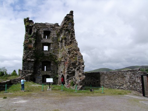
 804b. One of the recent Medieval re-enactment days in Bishop Lucey Park


Kieran’s Our City, Our Town, 30 July 2015

803a. Excavating skeletons at Crosses Green, 1993

Kieran’s Our City, Our Town Article,

Cork Independent, 30 July 2015

Cork Harbour Memories (Part 29)

Skeletons beneath our Feet


    Previously, we discussed the Dominican Abbey at what is now Crosses Green. Exciting finds were unearthed in 1993 during the placing of foundations for the Crosses Green Apartment Complex. Excavated remains of buildings were discovered associated with the abbey especially the church, cloister or central walking area and other attached domestic buildings. Among these buildings, many medieval objects were found as well as one of the most preserved graveyards ever found in post medieval archaeological studies. All were studied under the watchful eye at the time of former City Archaeologist, Maurice Hurley and Cathy Sheehan (1995, see local studies in the City Library for their insightful excavation report)

    Part of the finds included the remains of medieval pottery. Clare McCutcheon in her section in the excavation report noted that the largest assemblage came from the south-west of France from the Saintonge area and were early thirteenth to fourteenth century in date. In addition, native Cork type pottery was discovered as well as Redcliffe pottery from Bristol.

    Nearly a half a dozen bone and antler artefacts turned up. These included a modified antler tine or an object used in some manufacturing or shaping process of bone or antler. A broken needle associated with medieval weaving was found along with what is described as a type of toggle to hold clothes together. Rosary beads or paternosters were found. Forty-two beads were, all bone in nature. The beads were found in relation with the torso of a skeleton in a grave.

   Metal objects were discovered of which many were bronze in nature. These included several bronze pins, a needle, an ear spoon (from a toilet set or a surgical instrument set), a ring brooch, which would been used to fasten the cloaks of the monks, a buckle, the hand guard of a dagger, a tweezers, and an iron knife blade. Lead objects included nine lead rods, which were part of stylii or writing leads. Only one medieval coin of a medieval date was found, fourteenth to fifteenth century in date. One piece of structural timber was found, which was said to maybe part of a quay front revetment, a bridge, or a scaffolding piece used in the construction of the priory.

   A total of two hundred graves were found. Under the careful excavation of Catyrn Power, the majority of the graves were discovered within the boundaries of buildings especially within the church and cloister area. Since, the abbey was built on a marshy island, there was a lack of acid in the underlining soil which resulted in little deterioration of the bones of skeletons found. All were reburied appropriately and safely. The majority were excellently preserved and therefore most of the graves comprised of intact comprehensible skeletons. Incidently the first graves associated with the Dominican Abbey are recorded as being located in 1804 when a Mr Walker unearthed several stone lined graves. He was building his own distillery at the time chose not to disturb the burials to any great extent.

   Catyrn in her report notes three main types of graves discovered, which give an insight into the social structure around the area of the abbey. These types included shallow unlined graves which the majority of burials consisted of. In a few unlined graves, an unusual burial practice was noted. Small stones known as pillow stones or other skulls were placed on either side of the skull of the main skeleton in order to keep the skull itself from collapsing to one side.

   The second type of grave found on the grounds of the Dominican Abbey was related to the evidence for charred coffins. In England, during the medieval period, charred coffins were utilised so that the decomposition of wood would be deterred. Stone-lined graves with slab capstones also made up a large part of the burials at Crosses Green. Associated with several of these type of graves on top of them were tomb slabs and effigies (carved statues in stone).

   Three-quarters of the individual skeletons were found to be adults – the largest number being aged in their twenties There seemed to be slightly more males than females excavated. The mortality rate was found to be low and through present day research on medieval times, numerous reasons have for this have come to the forefront such as diet and living standards of the time. Poor living conditions in the nearby walled town and the abbey led to breeding grounds for rats and infectious diseases. In the town overcrowding was common in poorly ventilated dwellings with thatched roofs that had a clay floor which was an attraction to rats and fleas. The water supply was always subject to contamination from sewage and rubbish. Household waste was thrown onto the streets and laneways. Even dead animals were left to decay where they fell. Clothing and hair provided shelter from fleas and lice. Life was tough in medieval Cork.

    In the case of the skeletons excavated and analysed at Crosses Green, just less than half were found to have degenerative joint disease or some form of arthritis. In several individual skeletons, nutritional deficiencies, tumours, dental diseases were noted along with infections. All these can be detected due to their changing effect on the shape and strength of the bone.

 Check out Catyrn Power’s excellent blog, https://corkarchaeologist.wordpress.com/

 To be continued…


Captions: 

803a. Excavating skeletons at Crosses Green, 1993 (pictures: Catyrn Power, https://corkarchaeologist.wordpress.com

803b. Excavating skeletons at Crosses Green, 1993 (pictures: Catyrn Power, https://corkarchaeologist.wordpress.com)

 803b. Excavating skeletons at Crosses Green, 1993

Kieran’s National Heritage Week Tours 2015

Monday 24 August 2015 – Tales of the City’s Workhouse, historical walking tour with Cllr Kieran McCarthy, meet at entrance to St Finbarr’s Hospital, Douglas Road, 7pm (free, duration: two hours).


Wednesday 26 August 2015 – From Market Gardens to Architectural Eminence, historical walking tour of Turners Cross and Ballyphehane with Cllr Kieran McCarthy, meet at entrance to Christ the King Church, Turners Cross, 7pm (free, duration: two hours).


Friday 28 August 2015 – Cork’s Elegant Suburb, Historical walking tour of Sunday’s Well with Cllr Kieran McCarthy, meet at St Vincent’s Bridge on the North Mall side, 7pm (free, duration: two hours).


Saturday 29 August – Park Stories, Historical walking tour of Fitzgerald’s Park with Cllr Kieran McCarthy, meet at band stand in park, 2pm (free, duration: two hours)

Kieran’s Our City, Our Town, 23 July 2015

 802a. View of recent Shandon Street Festival 2015

Kieran’s Our City, Our Town Article, 

Cork Independent, 23 July 2015

Shandon and Blackpool Historical Walking Tours


    I have two more summer walking tours coming up – this time the focus is on the Shandon and Blackpool area – Friday evening, 24 July is the Shandon historical walking tour; discover the city’s historical quarter; learn about St Anne’s Church and the development of the butter market and the Shandon Street area; meet at North Gate Bridge, 6.45pm (free, duration: two hours). The second walking tour weaves through Blackpool, Thursday evening 30 July 2015; from Fair Hill to the heart of Blackpool, learn about nineteenth century shambles, schools, convents and industries, meet at the North Mon gates, Gerald Griffin Avenue, 6.45pm (free, duration: two hours).

  The walking tours intertwine from Shandon into Blackpool and Gurranbraher highlighting several centuries of life in these corners of historic Cork from education to housing to politics, to religion, to industry and to social life itself. Tradition is one way to sum up the uniqueness of Shandon Street. Despite being a physical street, one can stroll down (or clamber up), the thoroughfare holds a special place in the hearts of many Corkonians. The legacy of by-gone days is rich. The street was established by the Anglo-Normans as a thoroughfare to give access to North Gate Drawbridge and was originally known as Mallow Lane. Shandon Street locals identify with the special old qualities of the street. Different architectural styles reflect not only the street’s long history but also Cork’s past.

  In the time of the Anglo Normans establishing a fortified walled settlement and a trading centre in Cork around 1200 A.D., North Gate Drawbridge formed one of the three entrances –South Gate and Watergate being the others. North Gate Drawbridge was a wooden structure and was annually subjected to severe winter flooding, being almost destroyed in each instance. In May 1711, agreement was reached by the council of the City that North Gate Bridge be rebuilt in stone in 1712 while in 1713, South Gate Bridge would be replaced with a stone arched structures. The new North and South Gate bridges were designed and built by George Coltsman, a Cork City stone mason/ architect.

  Between 1713 and the early 1800s, the only structural work completed on North Gate Bridge was the repairing and widening of it by the Corporation of Cork. It was in 1831 that they saw that the structure was deteriorating and deemed it unsafe as a river crossing for horses, carts, and coaches. Hence in October 1861, the plans by Cork architect Sir John Benson for a new bridge were accepted. In April 1863, the foundation stone for the new bridge was laid. The new bridge was to be a cast-iron structure with the iron work completed by Ranking & Co. of Liverpool. An ornate Victorian style was incorporated into the new structure with features such as ornamental lamp posts and iron medallions depicting Queen Victoria, Albert the Prince Consort, Daniel O’ Connell, the Irish Liberator and Sir Thomas Moore, the famous English poet. The new North Gate Bridge was officially opened on 17 March, St Patrick’s Day 1864 by the Mayor John Francis Maguire in the company of Sir John Benson, the designer and Barry McMullen, the contractor. Nearly 100 years later – circa early 1960s, the bridge would have to be reconstructed again due to increased traffic.

  On 6 November 1961, the new and present day bridge, of concrete slabs was opened by Lord Mayor, Antony Barry TD accompanied by the Parish Priest of SS. Peter’s and Paul’s Church, the Rev. Canon J. Fehily who blessed the structure before it was opened. The new bridge was named Griffith Bridge in honour of Arthur Griffith head of the Irish delegation at the negotiations in London that produced the Anglo-Irish Treaty of 1921.

    There are multiple layers of history around the Shandon quarter. Amongst them is the story of the great butter market. By the mid 1700s, the native butter industry in Cork had grown to such an extent due to British empire expansion that it was decided among the main city and county butter merchants that an institution be established in the city that would control and develop its potential. The Committee of Butter Merchants located themselves in a simple commissioned building adjacent to Shandon. The committee comprised 21 members who were chosen by the merchants in the city.

    Blackpool was the scene of industry in Cork in the eighteenth and nineteenth centuries for industries such as tanning through big names such as Dunn’s Tannery and distilling through families such as the Hewitts. The leather industry at one vibrant in Blackpool with no fewer than 46 tanyards at work there in 1837 giving employment to over 700 hands and tanning on average 110,000 hides annually. Blackpool also has other messages about relief in the form of the former Poor House site at Murphy’s Brewery to Madden’s Buildings to highlighting the work of Ireland’s social reformers through street names such as William O’Brien, Gerald Griffin, Daniel O’Connell and Tomas McCurtain. All these messages inject the place with memories of difficult times but also times of determination to survive against the odds.

 See you on the tours!

Captions:

 802a. View of recent Shandon Street Festival 2015 (picture: Kieran McCarthy)
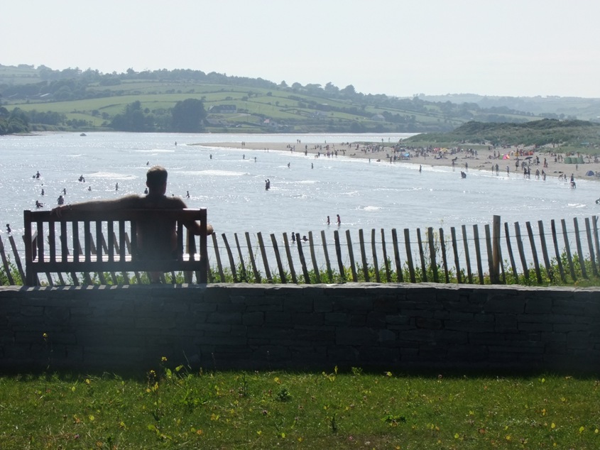
 802b. View of recent Shandon Street Festival 2015 (picture: Kieran McCarthy)
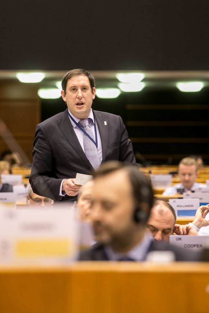
802b. View of recent Shandon Street Festival 2015