Kieran’s Our City, Our Town, 28 April 2016
Kieran’s Our City, Our Town Article,
Cork Independent, 28 April 2016
Remembering the 1916 Rising
This week marks the actual centenary of the 1916 Rising. It is most apt to note that across the country 100 years ago, thousands of Irish volunteers waited for the order to come to Dublin to take the Capital. By 1916 the national figure for volunteer membership had risen to 15,000. The 1,600- strong rebel force in Easter week contained 1,300 Volunteers and over 200 from the Irish Citizen Army; this amalgamated battalion was designated by the insurrectionary leaders as ‘the Army of the Irish Republic’.
Journalist Niall Murray in his research remarks that on St Patrick’s Day, 1916, thousands of men and boys in uniform — almost half of them carrying arms — took to the streets of cities and towns to demonstrate the growing membership. From almost 40 county inspectors (Cork, Galway, Tipperary and others were split into two Ridings), reports compiled in RIC headquarters put the numbers who turned out at just over 4,500 outside Dublin city. When 1,400 who paraded there — from among the capital’s estimated 2,225 Irish Volunteers — were added, it was seen that a total 5,955 members of the organisation had shown up at nearly 40 events in 19 counties.
Tomás MacCurtain was the Brigade Commander of the Irish Volunteers in Cork city and county in 1916 and he had organised volunteers to march to Kerry to collect guns from the German ship, the Aud which was to land the weapons at Fenit. Their head-quarters was at the Volunteer Hall on Sheares Street, upon which a new memorial was unveiled by Cork City Council in recent weeks.
Research by Dan Breen of Cork City Museum is now shown in newly erected historical panels on walls opposite the Volunteer Hall. In February 1915 the leadership of the Cork Brigade of Irish Volunteers signed a lease on a large building at Sheares Street for use as a headquarters. Unlike their old headquarters on Fisher Street, the building had a sufficient number of rooms to allow concurrent activities such as arms drill, map reading and first aid classes to take place on days when training was conducted on the premises.
On Easter Sunday morning, 23 April 1916, 163 Volunteers from the Cork City Battalion, together with others from Cobh and Dungourney, paraded under arms outside of the Volunteer Hall prepared to take part in the manoeuvres that were a cover for the Rising planned to establish an independent Irish Republic. After an address by Brigade Commandant, Tomás MacCurtain, they marched off to Capwell Railway Station to board a train for Crookstown. However, just as they were departing, an order arrived from Dublin cancelling the operation. This was the latest in a series of conflicting orders that had been received by MacCurtain during the past week.
That day just over members of the Cork Brigade mobilised and assembled at eight designated concentration camps throughout the county. But, when he received the latest order, MacCurtain felt he had no choice but to stand his men down and order them to return home. When Tomás MacCurtain returned to the Volunteer Hall on Easter Monday evening he learned that the rising had commenced in Dublin. As his men had dispersed and the element of surprise had been lost, he decided that it was too late to join the fighting and that his best course of action would be to defend the Volunteers against the British Army. Negotiations between both parties mediated by the Lord Mayor of Cork, Cllr Thomas C Butterfield and Bishop Cohalan eventually led to a peaceful settlement. The deal involved the Irish Volunteers agreeing to hand over their guns on the understanding they would be returned at a later date in return for being allowed to return home but MacCurtain was arrested and detained in Frongoch internment camp in Wales along with those who fought in Dublin. Shortly after his return to Cork he was elected Lord Mayor in January 1920 and at the same time continued to hold the rank of brigade commander of the IRA. On his 36th birthday, 20 March 1920 MacCurtain was shot dead by the Royal Irish Constabulary in front of his wife and son at their home in Blackpool, which was then ransacked.
All the above historical elements are explored at the Military Museum, Collins Barracks, Cork City. The exhibition is entitled “Order, Counter-order and Disorder” – Cork in Easter 1916 (opening Monday to Thursday from 10am to 1pm and opening on Friday from 10am to 1pm and 2pm to 3pm). An exhibition on the 1916 rising is opening this week in Cork City Museum – it explores its connection to Cork City – illustrating people, places and events connected to Easter Week in Cork. In addition, check out in the historic St. Peter’s Church this year which is home to the “Rebellion!” exhibition curated by Rachel Abraham, which explores the people and organisations that went beyond the ideals of an Irish Republic and laid the foundations for its reality. It places the Rising in context by outlining the issues of the time, e.g. home rule and the outbreak of World War One. The exhibition shows why the effects of the Rising have been so far-reaching that we still remember those individual men and women today.
Captions:
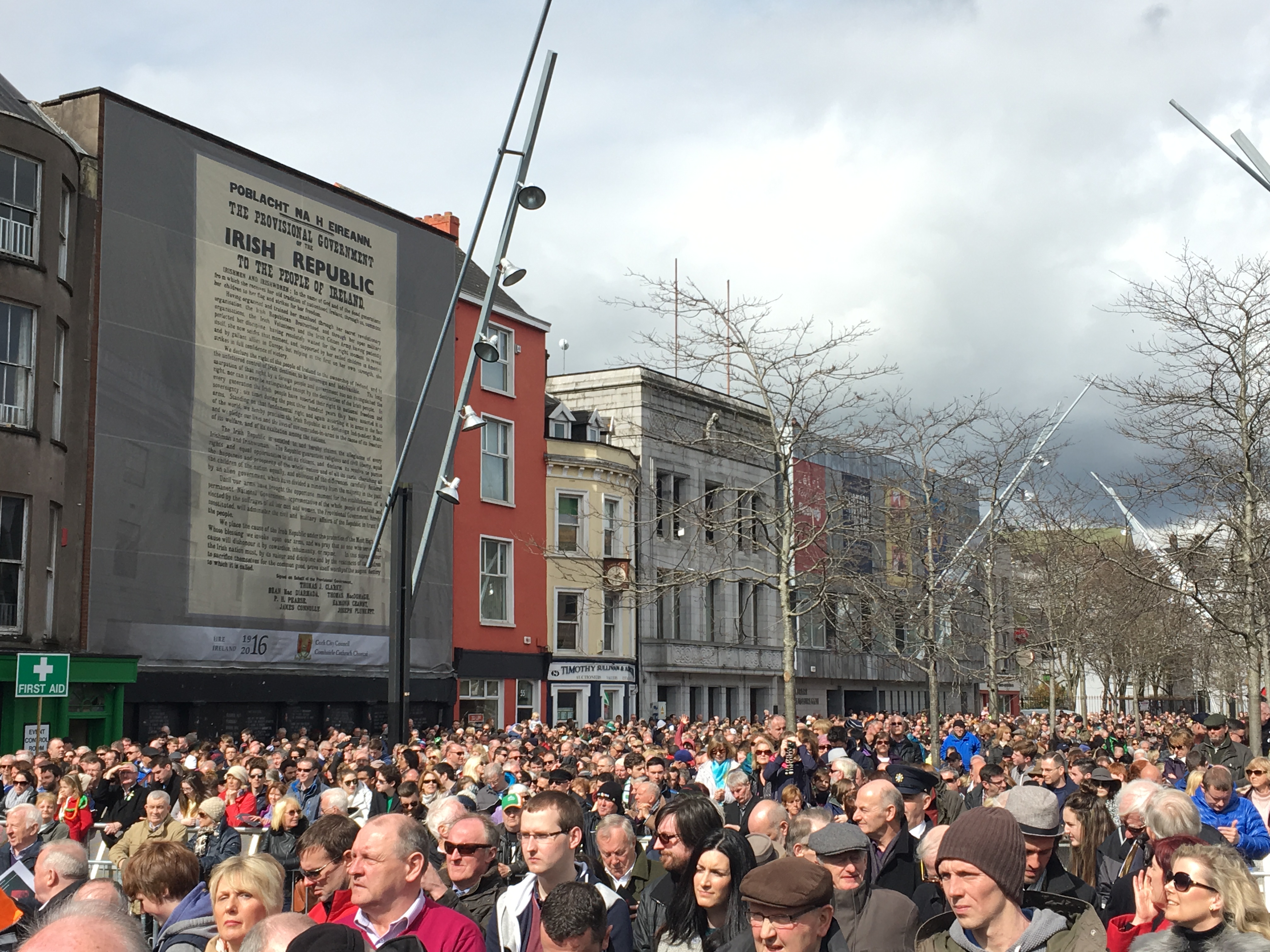
841a. Crowds beneath the printed Proclamation during the recent Easter Monday Commemorations 2016 (picture: Kieran McCarthy)
841b. Photograph of officers of the Cork Brigade outside the office of the Freeman’s Journal in Dublin; back row: Daithí Cotter, Seán Murphy, Donal Barrett, Terence MacSwiney, Pat Trahey; front row: Tadgh Barry, Tomás MacCurtain & Pat Higgins (source: Cork City Museum)
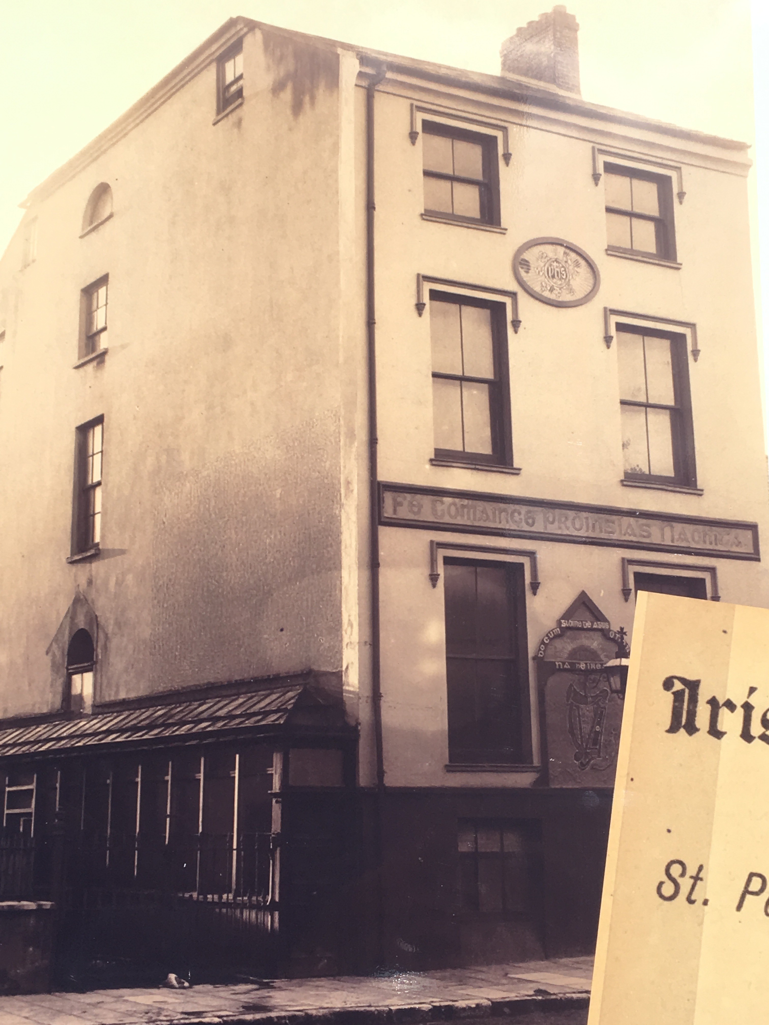
841c. Cork Volunteer Hall, Sheares Street (source: Cork City Museum)

Update, Blackrock Harbour and Village Renewal Project, April 2016
In response to a recent question to the Chief Executive of Cork City Council by Cllr Kieran McCarthy for an update on the current work programme of the Blackrock Harbour and Village Renewal Project, a report was issued. The construction period for phase 1 has commenced, comprises 43 weeks and the project should be substantially completed in January 2017. This will consist of the realignment and widening of Convent Road, Blackrock Road and the Marina including boundaries, footpaths, surfaces, crossing and underground utility works common to phases 1 and 2. The scope of work will be limited to the current level of available funding. Further efforts will be made this year to secure the remaining funding so that work on phase 2 can commence at an early date. Funding applications have been made to a number of agencies including the Department of Agriculture, Food and the Marine, the National Transport Authority and the South East Regional Authority. Unfortunately, however these applications have not been successful. In the absence of additional funding, the Council proposes to split the tendered works into phases and to proceed with that portion of the works that can be executed. Commenting, Cllr McCarthy noted: “this has been a long, difficult and frustrating process of planning work over two decades. It’s a testament to the tenacity, patience and good will of Blackrock residents who have pushed and pushed to make this current construction phase happen”.
SEDEC: Debate on EU response to demographic challenge, labour mobility and Digital Single Market
20/04/2016
On 20th of April 2016, the SEDEC commission of the EU Committee of the Regions brought to the table for discussion its opinion on the EU response to the demographic challenge. EA coordinator for SEDEC commission, Cllr Kieran McCarthy welcomed the opinion, underlining at the same time the enormous need for synergies between the EU and grassroots actions, as well as more coherence between the different funds and instruments that may be used to tackle this challenge such as CAP, Cohesion Policy or ERDF. ‘It is necessary to join up the dots more and coordinate’, said Cllr McCarthy. Sound family policies are extremely relevant in this context, as well as a particular focus on youth problems.
The CoR study on Labour mobility and Local and Regional Authorities has been presented during the SEDEC commission, looking at the EU mobility data, benefits of EU labour mobility, main challenges and risks, as well as some recommendations for policies to improve labour mobility. In this context, Kieran McCarthy raised the question of support for those countries that are being brain-drained, i.e. facing emigration of highly trained or qualified people.
During the debate on the Digital Single Market, DG CONNECT representative Ms Lucilla Sioli outlined the actions undertaken by the Commission in view of strengthening the digital single market and opening up opportunities for people and businesses in the digital economy. One controversial point brought up by the EA coordinator was the double-edged effects of E-commerce. On one side, digitalisation is much welcomed and rural broadband is now helping connecting people, while on the other side, small shops are facing the danger of shutting down due to the strong competition of e-commerce. Cllr. McCarthy stressed the need to find a balance and compensate the weak position that small business are now facing through adequate policies.
Kieran’s Our City, Our Town, 21 April 2016
Kieran’s Our City, Our Town Article,
Cork Independent, 21 April 2016
Crazy for You
My second foray with Cork City Musical Society brings Crazy for You the musical from 29 April to 1 May in the Firkin Crane Shandon, four performances (three evening shows and a matinee). The show for all the family is being directed by myself, has a cast of 30 and a 7-piece band, with musical direction by Michael Young and choreography by Aisling Byrne Gaughan.
We are delighted to present our musical to the public. Our cast of 30 have worked very hard on this production to bring a toe-tapping, sing-along and funny musical, which will leave a smile on the faces of the audience. Amateur musical societies are multiple in nature up and down the country. All bring their local communities together under a volunteer and charity umbrella – collaborating and bringing people together to create an outlet for people and to put drama, music and all ultimately form a key cultural vein within towns and villages. It is important that a city such as Cork has a musical society to promote the inherent love for musical theatre.
Crazy for You is a romantic love musical with lyrics by Ira Gershwin, and music by George Gershwin. Billed as “The New Gershwin Musical Comedy”, it is largely based on the song writing team’s 1930 musical, Girl Crazy, but incorporates songs from several other productions as well. George and Ira Gershwin will always be remembered as the songwriting team whose voice was synonymous with the sounds and style of the Jazz Age. By the time of their 1924 Broadway hit, Lady Be Good!, George had worked with lyricist Buddy DeSylva on a series of revues, George White’s Scandals, while Ira reveled in success with composer Vincent Youmans on Two Little Girls in Blue. But from 1924 until George’s death in 1937, the brothers wrote almost exclusively with each other, composing over two dozen scores for Broadway and Hollywood. Though they had many individual song hits, their greatest achievement may have been the elevation of musical comedy to an American art form.
The history of jazz has its roots firmly planted in the American cities of New Orleans, Chicago, and New York City. And the musical tradition within these cities still lives on today. As jazz spread around the world, it drew on different national, regional, and local musical cultures, which gave rise to many distinctive styles. New Orleans jazz began in the early 1910s, combining earlier brass-band marches, French quadrilles, ragtime and blues with collective polyphonic improvisation. In the 1930s, heavily arranged dance-oriented swing big bands, Kansas City jazz, a hard-swinging, bluesy, improvisational style and Gypsy jazz (a style that emphasized musette waltzes) were the prominent styles. Ira Gershwin was a joyous listener to the sounds of the modern world. He had a sharp eye and ear for the minutiae of living. He noted in a diary: “Heard in a day: An elevator’s purr, telephone’s ring, telephone’s buzz, a baby’s moans, a shout of delight, a screech from a ‘flat wheel’, hoarse honks, a hoarse voice, a tinkle, a match scratch on sandpaper, a deep resounding boom of dynamiting in the impending subway, iron hooks on the gutter”.
In studying the history of jazz music on the other side of the Atlantic, it is very interesting to research the anti-jazz movement in Ireland in the 1930s. It is difficult to imagine the halting of such glorious toe-tapping music such as “I Got Rhythm”. In an article in the History Ireland magazine (1993) by Jim Smyth entitled Dancing, Depravity and all that Jazz, The Public Dance Halls Act of 1935 he notes the pressure for constraints on the dance halls was becoming forceful. The Gaelic League re-launched its anti-jazz campaign in 1934 with a statement very much in tune with the sentiments of the bishops: “It is this music and verse that the Gaelic League is determined to crush…its influence is denationalising in that its references are to things foreign to Irishmen: that it is the present day instrument of social degradations all too plain, even in Ireland. That was the reason for their-launching of the anti-jazz campaign, the reason it received the blessing of the church and the approval of the state. The League was quick to condemn politicians who were seen as behavin an ‘anti-national’ fashion”. The Secretary of the League, attacking the broadcasting of jazz on Radio Éireann, had this to say about the minister responsible: “Our Minister of Finance has a soul buried in jazz and is selling the musical soul of the nation for the dividends of sponsored jazz programmes. He is jazzing every night of the week”. A number of County Councils adopted resolutions condemning jazz and all-night dancing. In January 1934 a large demonstration took place in Mohill, County Leitrim. It was made up mostly of young people and the press estimated the attendance at 3,000, with five bands and banners inscribed with “Down with Jazz” and “Out with Paganism”. Support came from church and state.
But one can imagine that deep within some dance halls, the needs to release this soulful and spirit enhancing music. Come and enjoy Cork City’s musical production of Crazy for You, 29 April-1 May, see www.firkincrane.ie for tickets.
Captions:
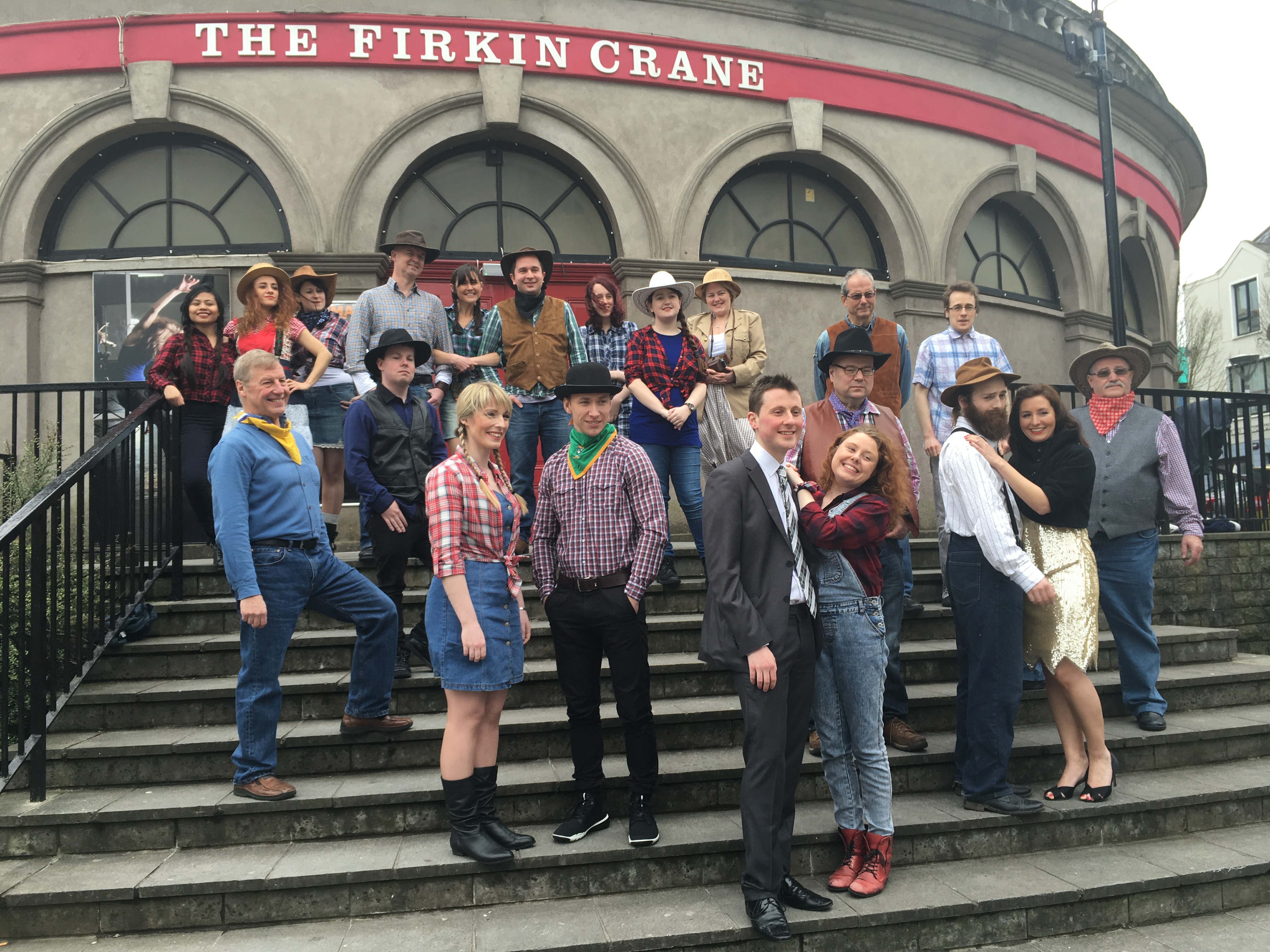
840a. Some of the cast for the upcoming Cork City Musical Society production of Crazy for You, The New Musical; 29 April-1 May, www.firkincrane.ie for tickets (picture: Kieran McCarthy)
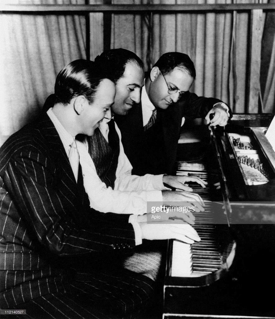
840b. George Gershwin at piano with Ira Gershwin and Fred Astaire (source: Getty Images)
Kieran’s Our City, Our Town, 14 April 2016
Kieran’s Our City, Our Town Article
Cork Independent, 14 April 2016
Talk on Daily Life in 1916
Next Saturday 16 April at 11am, as part of the Lifelong Learning Festival Week, I will give a talk on Cork and daily life in 1916 in the Cork City and County Archives in Blackpool (all free, all welcome). It will form part of the half day seminar entitled Cork and the Easter Rising. Speakers will also include Dr John Borgonovo (UCC), Cork and the 1916 Rising (12noon); at 1.30 pm Rosaleen Underwood (Prof. Genealogist) will speak on Roibárd Langford, His Family History and his role in 1916 in Cork (Lieutenant, Cork No. 1 Brigade). Mark Cronin will speak on Blackpool in 1916: A Cork Suburb at the Crossroads (2.30 pm). Come for one talk or all of them. Booking at 0214505887.
I am currently working on a project that takes the year 1916 from the point of view that there were multiple conversations to be heard during the year – a kaleidoscope of ideas which provided the context and framework for revolution – everyday life being one – some led Cork citizens to connect with the Republican mantra at the time and others to just maintain existence, survive and struggle with the bleakness of a national and local economy. Entering the Cork Examiner on 1 January and progressing page by page one discovers key nuggets about the nature of Cork society, the soul of Ireland’s southern capital, the ongoing conversations about maintaining a contemporary status of being one of Ireland‘s distinguished port cities, and all the advantages and problems that run with that.
January 1916 begins with the aftermath of a winter storm – buildings were windswept and damaged, transport networks such as the City’s tramways were indented – as such there was nothing the Corporation of Cork and the citizens could do but sit it out and wait; much was out of their hands; the storm was something bigger than themselves. Indeed, the thread ‘much was out of their hands’ permeated throughout Irish society at this time – pervaded Cork society at this time. Despite, the rationing of food and materials, the pulses of society in Cork retained it as an ambitious place. Unemployment, jobs, requests for wage increases, Union Interventions, the role of employers and the needs of rate-payers reverberate in the pages throughout the year. The debates of the Cork industrial Association pops up in discourse throughout the pages of the paper, their efforts culminating in the large scale announcement of Ford Tractor and Car manufacturing coming to Cork in 1917. The Cork Harbour Board revelled in this announcement as well as plans for the physical rejuvenation of its quays. Another artery of the city was its train network travelling into County Cork. One can read about the benefits of such lines as the Cork Bandon and South Coast Railway, the Cork Muskerry Tram, the Cork Blackrock and Passage Railway Line connecting people, animals, fisheries and place from the coast and hinterland to the city and vice-verse – igniting the region and city into one. The same direction was pushed by the Munster Agricultural Society – whose aims consistently led to discussions on the role of land, cattle, the prices of Ireland’s traditions and industries – exports destinations, and ultimately the intertwinement into the British Empire.
The city’s institutions such as its hospitals – Mercy Hospital, South and North Infirmary, and institutions such as the City and County gaols, the Magdalene Asylum, the Sailor’s Home as well the City’s workhouse or Cork Union record the need to address the needs of society and to provide more financial aid and food to citizens immersed in large scale poverty.
The other pillars of Cork Society were its educational ones – the core schools that appear are the North Monastery, the South Presentational Convent, Crawford Municipal Technical Institute and the Cork School of Commerce. All continue through the press to showcase the importance of education and life-long learning in escaping from poverty and to help the overall societal pull to a better life.
The role of the Catholic church in society is ever felt – the refusals to leave cinemas open on a Sunday, the role of public professions of faith in galvanising public expressions of religion through events such as the confraternities and Corpus Christi, are written about in depth. The death of Bishop O’Callaghan ended another chapter in the city’s religious life and opened a new one on the rise of Bishop Cohalan and his take on non-violence and faith-based community approaches.
The public representation by City Councillors and Lord Mayor Butterfield on municipal issues from the provision of social housing to park provision is enormous– there is the role of escapism in the programmes of Cork Opera House, the Palace Theatre – and even in Cork Park Racecourse – as horses galloped across its mud-soaked landscape. GAA matches, athletics, handball, cricket are all recorded in depth on the Monday edition.
There is much to learn from this time – not just on the political side but that life itself in any city keeps moving and that society needs to grow and evolve with it – and that even from a dark time in Ireland’s past, there is much to learn about the diverse framework of historical events and how they shape our lives and our future.
Captions:
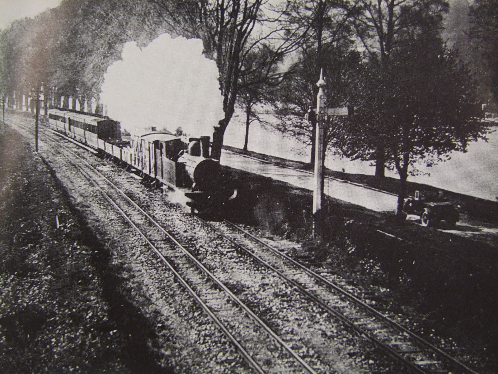
839a. Cork Blackrock & Passage train, The Marina, c.1920 (Source: Cork City Library)
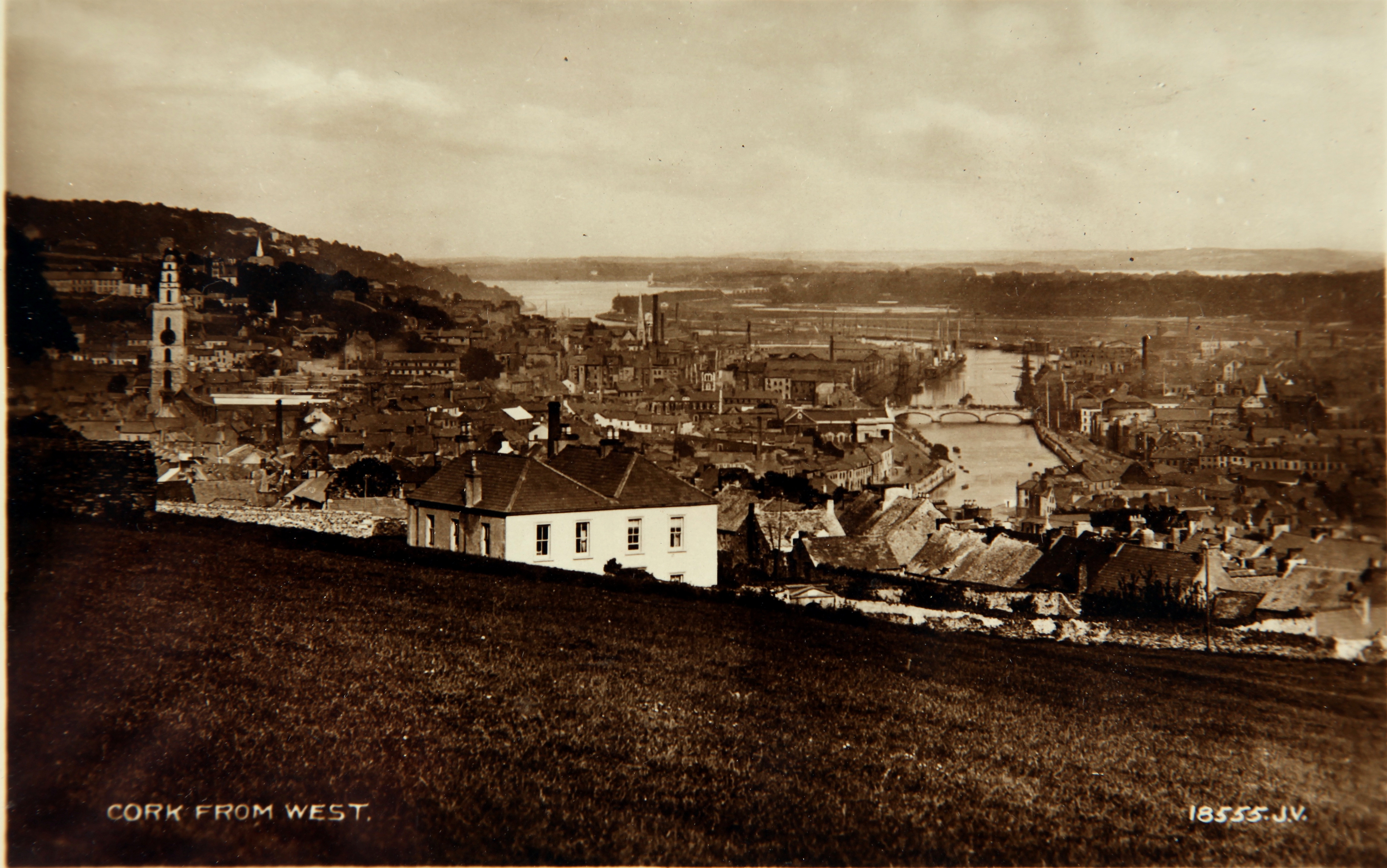
839b. View of Cork c.1910 (source: Cork City Museum from the book, Cork City Through Time by Kieran McCarthy & Dan Breen)
Cllr McCarthy’s Community Talent Competition 2016
Cork’s young people are invited to participate in the eighth year of Cllr Kieran’s McCarthy’s ‘Community Talent Competition’. The auditions will take place on Sunday 8 May between 10am-5pm in the Lifetime Lab, Lee Road. There are no entry fees and all talents are valid for consideration. The final will be held two weeks later. There are two categories, one for primary school children and one for secondary school students. Winners will be awarded a perpetual trophy and prize money of €150 (two by €150). The project is being organised and funded by Cllr Kieran McCarthy in association with Red Sandstone Varied Productions (RSVP).
Cllr McCarthy noted: “In its eight year, the talent competition is a community initiative. We generally get to audition people who have very little experience of performing. Within the audition process there is friendly feedback from our judges and if the auditionee gets through there are workshops to offer advice and support. The talent competition is all about encouraging young people to develop their talents and creative skills, to push forward with their lives and to embrace their community positively. I am delighted with the nuggets of talent that we have found in Cork communities over the years and very proud of those who post audition and competition, have taken up music, drama, and other elements of the performing arts within Cork – they engage with their talent and develop and enjoy it more”. Further details can be got from the talent show producer (RSVP), Yvonne Coughlan, 086 8764685 or email rsvpireland@gmail.com.
Kieran’s Question to the City Manager/ CE, Cork City Council Meeting, 11 April 2016
To ask the CE on (a) the progress of St Luke’s Church and the hand-over to Tigh Fili, and (b) the progress made in the negotiations with securing Civic Trust House going forward for the festival bodies? (Cllr Kieran McCarthy)
Kieran’s Talks, Lifelong Learning Festival Week
For the forthcoming Lifelong Learning Festival Week, Douglas Road Cllr Kieran McCarthy will give a talk on some of the histories of West Cork through old postcards at the meeting room of the Church of the Real Presence, Curaheen on Wednesday 13 April, 10.30am. Based on his book, West Cork Through Time, Cllr McCarthy noted: “The talk focuses on in selective detail postcards from Cork City museum of the region of West Cork from one hundred years ago. It takes the reader from Bandon to Castletownbere through the changing landscapes and seascapes. This region is a striking section of Ireland’s coastline, over 320 kilometres in length, encompassing a raw coastal wilderness with expansive inlets eroded away by the Atlantic Ocean. The old postcards represent many memories of the landscape, sold to visitors and locals a century ago.”.
Cllr McCarthy will also give a talk on Cork and daily life in 1916 in the Cork City and County Archives in Blackpool at 11am on Saturday 16 April (all free, all welcome). It will form part of the half day seminar entitled Cork and the Easter Rising. Kieran is currently working on a book that takes the year 1916 from the point of view that there were multiple conversations to be heard during the year – a kaleidoscope of ideas which provided the context and framework for revolution – everyday life being one – some led Cork citizens to connect with the Republican mantra at the time and others to just maintain existence, survive and struggle with the bleakness of a national and local economy. Cllr McCarthy noted: “Entering the Cork Examiner on 1 January and progressing page by page one discovers key nuggets about the nature of Cork society, the soul of Ireland’s southern capital, the ongoing conversations about maintaining a contemporary status of being one of Ireland‘s distinguished port cities, and all the advantages and problems that run with that”.
Kieran’s Our City, Our Town, 7 April 2016
Kieran’s Our City, Our Town Article,
Cork Independent, 7 April 2016
Discover Cork: Schools’ Heritage Project 2016
This year marks the thirteenth year of the Discover Cork: Schools’ Heritage Project co-ordinated by myself. The Project for 2016 recently culminated in two award ceremonies. It is open to schools in Cork City and County – at primary level to the pupils of fourth, fifth and sixth class and at post-primary from first to sixth years. A total of 44 schools in Cork took part this year. Circa 1200 students participated in the process and approx 200 projects were submitted on all aspects of Cork’s history.
One of the key aims of the project is to allow students to explore, investigate and comment on their local history in a constructive, active and fun way. The emphasis is on the process of doing a project and learning not only about your area but also developing new personal skills. Many of the topics in the city such as Shandon or UCC have a myriad of history books written on them. However, the challenge in this project is to get students to devise methodologies that provide interesting ways to approach the study of local history for up-and-coming generations. Submitted projects must be colourful, creative, have personal opinion, imagination and gain publicity. These elements form the basis of a student friendly narrative analysis approach where the students explore their project topic in an interactive way. In particular students are encouraged to attain primary material through engaging with a number of methods such as fieldwork, interviews with local people, making models, photographing, cartoon creating, and making short films of their study topic.
Students are to experiment with the overall design and plan of their projects. It attempts to move the student to become more personal and creative in their approaches. Much of the work could be published as local heritage / history guides to people and places in the region. For example, a winning class project from Cork Educate Together on Grattan Street this year focussed on the history of 1916 in Cork City Centre researched it, mapped out its legacies through interviewing local people and even added in their own mixed family history to add to the complexity of the 1916 narrative. Light was shone on lesser commemorated volunteers who fought in Dublin in the Rising – for example born in 1887, near Drinagh, Sean Hurley was the only Corkman who died in or was executed for his participation in the 1916 Easter Rising. In literature about Michael Collins you will see Sean’s name. Sean’s sister Kate was Michael’s sister-in-law; she was the first wife of Michael’s oldest brother Johnny Collins. To commemorate the memory of Sean Hurley and his fallen comrades, a day of celebration and remembrance, in their honour will be held in Drinagh, County Cork, 1 May 2016.
This year marks went towards making a short film or a model on projects to accompany history booklets. Submitted short films this year had interviews of family members, neighbours to local historians to the student taking a reporter type stance on their work. Some students also chose to act out scenes from the past. Students from Our Lady of Lourdes National School, Ballinlough this year composed a rap song on the story University College Cork.
The creativity section also encourages model making. The best model trophy in general goes to the creative and realistic model. Models of Cork City Gaol and St Anne’s Church, Shandon featured this year in several projects – not only physical models but Minecraft digital models as well.
Every year, the students involved produce a section in their project books showing how they communicated their work to the wider community. It is about reaching out and gaining public praise for the student but also appraisal and further ideas. Some class projects were presented in nursing homes to engage the older generation and to attain further memories from participants. Students were also successful in putting work on local parish newsletters, newspapers and local radio stations and also presenting work in local libraries. This year the most prominent source of gaining publicity was inviting the public into the classroom for an open day for viewing projects or putting displays on in local GAA halls, credit unions, community centres and libraries.
Overall, the Discover Cork: Schools’ Heritage Project attempts to provide the student with a hands-on and interactive activity that is all about learning not only about your local area but also about the process of learning by participating students. The project in the city is kindly funded by Cork Civic Trust (viz the help of John X Miller), Cork City Council (viz the help of Heritage Officer Niamh Twomey), the Heritage Council with media support from the Evening Echo as well. Prizes were also provided in the 2016 season by Lifetime Lab, Lee Road (thanks to Meryvn Horgan), Sean Kelly of Lucky Meadows Equestrian Centre Watergrasshill and Cork City Gaol Heritage Centre. The county section is funded by myself and students. A full list of winners, topics and pictures of some of the project pages for 2016 can be viewed at my website www.corkheritage.ie and on facebook at Cork, Our City, Our Town. For those doing research, www.corkheritage.ie has also a number of resources listed to help with source work.
Captions:
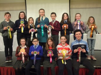
838a. Representatives of the County schools involved in the Discover Cork: Schools’ Heritage Project 2016 at the recent award ceremony in Silversprings Convention Centre (picture: Yvonne Coughlan)
838b. Tapestry from Derryclough NS, Drinagh commemorating the life of 1916 Rising participant, Sean Hurley (picture: Kieran McCarthy)
