In the Footsteps of St. Finbarre (Part 212)
The Pearls of Carrigrohane
“At the foot of the limestone rock, which constitutes the base of the building, is a cave, which the peasantry say, extends several miles underground, and communicates with the great caverns at Ovens, four miles distant. The River below this flows deep and darkly. In its waters is frequently found the Mytilus Margaritiferus or pearl muscle. Indeed at the very source of the River at Gougane Barra, large quantities of the fish may be procured, and it is known that the Mytilus may be made to produce pearls by artificial means” (John Windele, 1846, Guide to the South of Ireland, p.255).
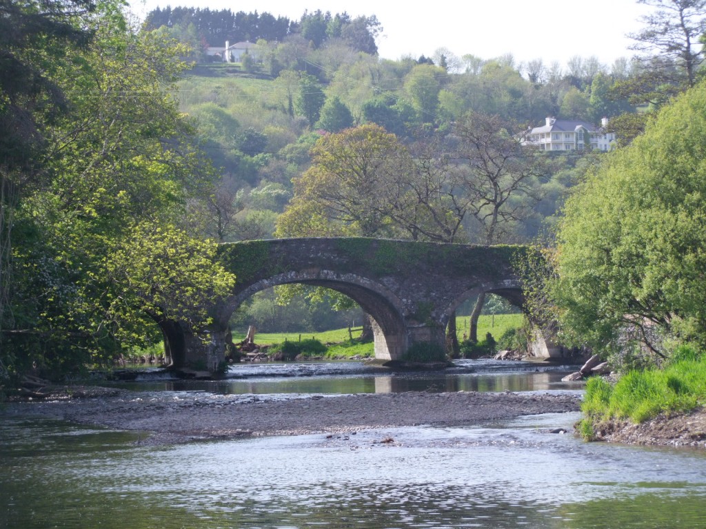
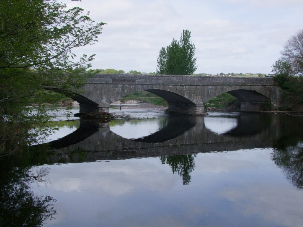
I have in passing in my entrances and journeys into the countryside of the Lee Valley admired a number of elements in the Carrigrohane area. Perhaps first and foremost for me the large and imposing number of human monuments such as the castle, church and bridges all reveal a tapestry of enduring stories. These, I feel, are captured and frozen in time between the busyness of Cork City’s western suburbs and the satellite town of Ballincollig. I have also stopped adjacent to the three limestone arched Leemount/ Carrigrohane Bridge at the Angler’s Rest. I have delighted in the swirling of the Lee below and the adjoining and spreading out pastural farmlands on the Lee’s floodplains. From here at different times of the day and year, Carrigrohane Castle appears in a different light continuously provoking the viewer to gaze and cherish.
In this part of the Lee, I have seen many a fisherman cast their line into the water and standing like statues, or as I always think like ambassadors standing to welcome the river to their area. Through the name Angler’s Rest, the pub draws attention to a way of life on the river. The joining of the Shournagh River to the Lee marks another milestone in the geography of the Lee Valley and makes for remarkable scenic views for those as my grandmother used to say who cast “one eye up the Shournagh”.
From historical sources, I have not been the first to stop adjacent Leemount/ Carrigrohane Bridge and reflect on this world. John Windele describes this part of the valley and adds his own colour to the memory of the landscape. He attempts to validate the beauty and sanctity at this spot by drawing on local folklore (p.255); “At a sudden bend of the River, is a deep pool, bearing the fearful name of Poul –an Ifrinn, or Hell-Hole. It is overhung by high limestone precipices, and from its neighbourhood, a highly beautiful view of the Castle is obtained. One of those fanciful eels of the supernatural class is said to inhabit this part of the river; he is of monstrous dimensions, has a mane of hair like a horse and two short feet. He is the guardian of enchanted abodes beneath, containing vast treasures. Heretofore, he often at night, quitted the waters, ad his track might be seen in the morning on the neighbouring grounds, but of late years, his visits have been rare as those of Angels.”
Samuel Lewis in his Topographical Dictionary of Ireland also comments on Carrigrohane. Circa 1835, the area contained 1921 inhabitants. He describes that the parish is situated on the south bank of the river Lee. Over the Lee was a stone bridge connecting it with a new line of road from Cork City into the heart of Inniscarra and eastwards through Magourney in Coachford to Macroom. This seemed to be part of a wider project at the time to improve access to the western approaches of the City. Another bridge was built over the River Shournagh as it enters the Lee. The Lee in Carrigrohane also powered a set of water wheels connected in a flour mill, which manufactured from 350 to 400 sacks of flour weekly. The mills offered local employment as did the Gunpowder Mills in Ballincollig.
Samuel Lewis notes of the land as of excellent quality, and the farms, being in the occupation of people with money, were in an excellent state of cultivation. From the low price of grain, the produce of the dairy and the grazing of cattle had been found more profitable than growing corn. The lands were therefore being converted into dairy farms. In addition Samuel Lewis points out that the parish forms part of the limestone district that extends from near the source of the River Bride, along its southern bank [through Ovens], across the vale to the west of the city of Cork, and passing through its southern suburbs, terminating at Blackrock. Lewis describes that the quarrying of limestone can be seen in the “comfortable appearance” and the improved state of the habitations of the local population.
An impressive structure that has survived the test of time and also one of the keys to unlocking the history of the region rests further is the Church of Ireland monument of St. Peter’s Church. The church in 1837 was a small plain edifice to which the Ecclesiastical Commissioners had granted funding for repairs to the amount of £143. It is said that the original church was built in the seventeenth century.
To be continued…
Captions:
540a. Bridge over the Shournagh River as it enters the River Lee near the Angler’s Rest, Leemount, May 2010 (pictures: Kieran McCarthy)
540b. Leemount/ Carrigrohane Bridge, May 2010
