Kieran’s Our City, Our Town Article,
Cork Independent, 19 August 2021
Kieran’s Heritage Week Audio Heritage Trails
The midway point has been reached for National Heritage Week 2021. There is still time to engage with my two virtual projects this year – the audio heritage trails of the Bridges of Cork and The Marina respectively. Usually, I am up to my eyes happily facilitating historical walking tours. But Covid is still scuppering my physical events. but hopefully the next few months will coincide with better news for the gathering of large groups that do not have to be socially distanced apart.
Both new audio trails are hosted by Meitheal Mara and I. All you need is your smartphone and some headphones. The first audio trail provides insights into the histories of the Cork city centre’s bridges, their place in Cork and some of their surrounding histories. The walk around the bridges is about two hours in duration. The trail is clockwise from South Gate Bridge up the south channel and down the north channel to cross back to the south channel. It ends at Nano Nagle Bridge.
They say the best way to get to know a place is to walk it. Through many centuries Cork has experienced every phase of Irish urban development. It is a city you can get lost in narrow streets, marvel at old cobbled lane ways, photograph old street corners, gaze at clues from the past, engage in the forgotten and the remembered, search and connect for something of oneself, and thirst in the sense of story-telling – in essence feel the DNA of the place. With so many layers of history in Cork, there is much to see on any walk around Cork City and its respective neighbourhoods. The River Lee has had and continues to have a key role in the city’s evolution. Many Corkonians and visitors have crossed over the River Lee’s bridges and have appreciated the river’s tranquil and hypnotic flow.
The audio trail begins at the oldest of the city’s bridges – that of South Gate Bridge. In the time of the Anglo Normans establishing a fortified walled settlement and a trading centre in Cork around 1200 AD, South Gate Drawbridge formed one of the three entrances – North Gate Bridge and Watergate being the others. A document for the year 1620 stated that the mayor, Sheriff and commonality of Cork, commissioned Alderman Dominic Roche to erect two new drawbridges in the city over the river where timber bridges existed at the South Gate Bridge and the other at North Gate.
In May 1711, agreement was reached by the council of the City that North Gate Bridge would be rebuilt in stone in 1712 while in 1713, South Gate Bridge would be replaced with a stone arched structures. South Gate Bridge still stands today in its past form as it did over 300 years ago apart from a small bit of restructuring and strengthening in early 1994.
The second of the new audio trails is on The Marina. A stroll down The Marina is popular by many people. The area is particularly characterized by its location on the River Lee and the start of Cork Harbour. Here scenery, historical monuments and living heritage merge to create a historical tapestry of questions of who developed such a place of ideas. Where not all the answers have survived, The Marina is lucky, that archives, newspaper accounts, census records and old maps and other insights have survived to showcase how the area and the wider area has developed. These give an insight into ways of life and ambitions in the past, some of which can help the researcher in the present day in understanding The Marina’s evolution and sense of place going forward.
Cork’s Marina was originally called the Navigation Wall or in essence it was an additional dock for ships adjacent to Cork City’s South Docks area. It was completed in 1761.
Following the constitution of the Cork Harbour Commissioners in 1814 and their introduction of steam dredging, a vigorous programme of river and berth deepening, quay and wharf building commenced. The dredger of the Cork Harbour Commissioners deposited the silt from the river into wooden barges, which were then towed ashore. The silt was re-deposited behind the Navigation Wall.
During the Great Famine, the deepening of the river created jobs for 1,000 men who worked on widening the physical dock of the Navigation Wall. In essence a fine road was constructed, which linked into Cork’s South Docks. To give an aesthetic to the new road, a fine row of elm trees was planted c.1856 by Prof. Edmund Murphy of Queen’s College Cork (now UCC). The elm trees were part of a crop and tree growing experiment.
In 1870, the Gaelic poet and scholar Donncha Ó Floinn put forward to the Improvements Committee of Cork Corporation that the new road of the Navigation wall be named Slí na hAbhann, which means the ‘pathway by the river’. Ó Floinn’s proposal was not accepted. The matter came before the Improvements Committee again in 1872. This time Ó Floinn suggested that the promenade be named ‘The Marina’. He outlined that ‘The Marina’ was the name allocated to a recently reclaimed piece of land near Palermo in Sicily. In July 1872, Cork Corporation formally adopted ‘The Marina’ as the name of the new road or promenade.
Listen to Kieran’s new audio trails under history trails at www.corkheritage.ie
Captions:
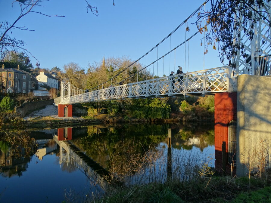
1113a. Daly’s Bridge aka Shaky Bridge, present day, which is one of the featured bridges in Kieran’s new audio heritage trail (picture: Kieran McCarthy).
1113b. The Marina, Cork, present day (picture: Kieran McCarthy).
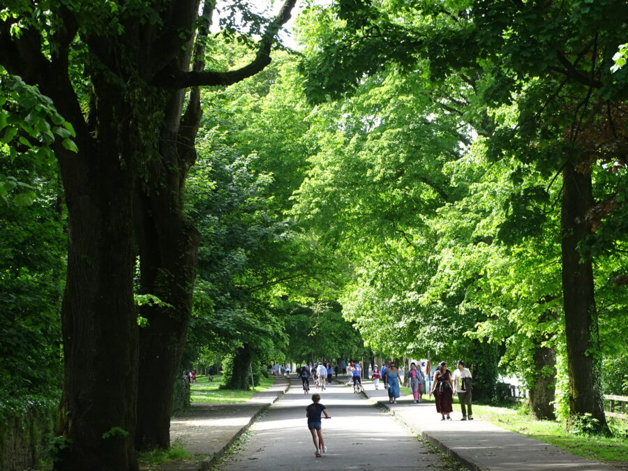
1113b. The Marina, Cork, present day (picture: Kieran McCarthy).